
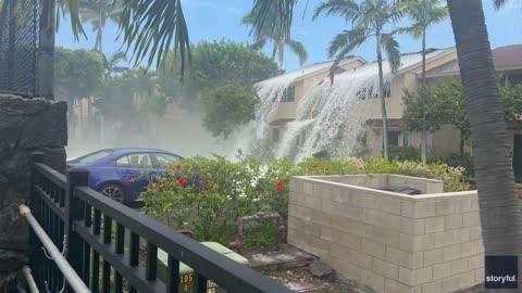
Heightened Severe Storm Risk for the Central Plains
A low pressure system will trigger severe thunderstorms this afternoon and evening across the Central Plains.
Read More
62degrees Fahrenheit

Feels like:62°
Hi:72°Lo:60°
70% Chance of Light Rain
Lo

Showers with thunderstorms likely in the evening then showers and chance of thunderstorms after midnight. Some thunderstorms may be severe with damaging winds large hail and heavy rainfall then some thunderstorms may produce damaging winds large hail and heavy rainfall after midnight. Locally heavy rainfall possible in the evening. Lows in the upper 50s. East winds 10 to 20 mph with gusts to around 30 mph. Chance of precipitation 90 percent.
Hi

Mostly cloudy with a 50 percent chance of showers and thunderstorms. Highs in the lower 70s. Northeast winds 10 to 15 mph with gusts to around 20 mph.

Closest strike in the last 30 minutes:64.8 miles
No Lightning Nearby


