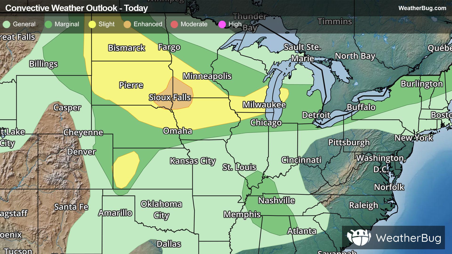
Upper Midwest, Appalachia to Spark Severe Storms
Storm systems moving across the Northern Tier will provide chances for severe thunderstorms in multiple regions today.
Read More
85degrees Fahrenheit

Feels like:88°
Hi:87°Lo:72°
Partly Cloudy
Hi

Partly cloudy. High temperature around 87F. Dew point will be around 70F with an average humidity of 86%. Winds will be 7 mph from the S.
Lo

Partly cloudy. Isolated showers after midnight. Lows around 72 near the shore to around 63 above 3000 feet. Northeast winds up to 15 mph. Chance of rain 20 percent.


Closest strike in the last 30 minutes:1226.4 miles
No Lightning Nearby


