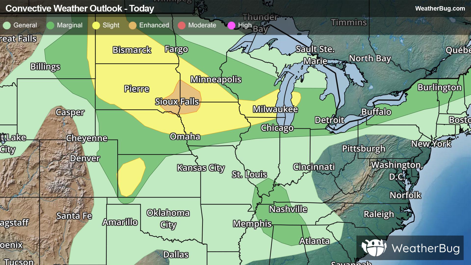
Upper Midwest, Appalachia to Spark Severe Storms
Storm systems moving across the Northern Tier will provide chances for severe thunderstorms in multiple regions today.
Read More
66degrees Fahrenheit

Feels like:66°
Hi:75°Lo:65°
40% Chance Rain Showers
Lo

Muggy. Mostly cloudy. Showers likely and a chance of thunderstorms in the evening then a chance of showers and thunderstorms after midnight. Lows in the upper 60s. Light and variable wind becoming southwest 5 to 10 mph after midnight. Chance of rain 70 percent.
Hi

Humid. Patchy fog in the morning. Mostly cloudy with a chance of showers and thunderstorms. Highs in the lower 80s. West wind 5 to 10 mph. Chance of rain 50 percent.


Closest strike in the last 30 minutes:180.9 miles
No Lightning Nearby


