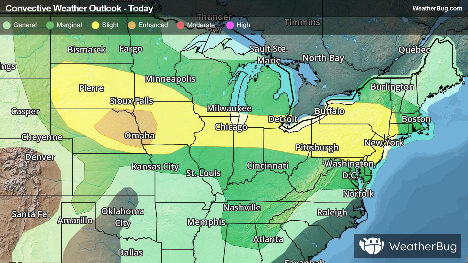
Severe Weather Stretches from High Plains to Northeast
Another round of severe weather will occur from the central and northern Plains through the Midwest and into Northeast today.
Read More
70degrees Fahrenheit

Feels like:70°
Hi:78°Lo:70°
Cloudy
Lo

Mostly cloudy with a 20 percent chance of showers and thunderstorms. Lows in the upper 60s. South winds around 10 mph with gusts to around 20 mph.
Hi

Sunny with a 20 percent chance of showers and thunderstorms. Hot and humid. Highs in the mid 90s. Southeast winds 10 to 15 mph with gusts to around 30 mph. Heat index readings 98 to 103.


Closest strike in the last 30 minutes:103.7 miles
No Lightning Nearby


