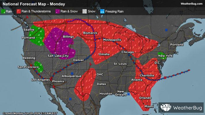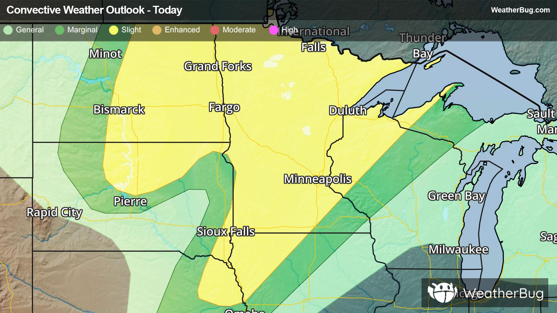
Severe Weather Underway For Northern Plains & Upper Midwest
A strengthening low pressure system will produce severe weather across the northern Plains and Upper Midwest today.
Read More
62degrees Fahrenheit

Feels like:62°
Hi:76°Lo:62°
50% Chance of Light Rain
Hi

Mostly cloudy with a chance of showers and thunderstorms in the morning then mostly sunny with a slight chance of showers and thunderstorms in the afternoon. Hot with highs around 90. Southeast winds 5 to 10 mph with gusts up to 20 mph. Chance of rain 50 percent. Heat index values up to 105.
Lo

Warm. Partly cloudy with a slight chance of showers and thunderstorms. Patchy fog after midnight. Lows 67 to 72. Southeast winds 5 to 10 mph becoming southwest after midnight. Chance of rain 20 percent.


Closest strike in the last 30 minutes:51.2 miles
No Lightning Nearby
A strengthening low pressure system will produce severe weather across the northern Plains and Upper Midwest today.