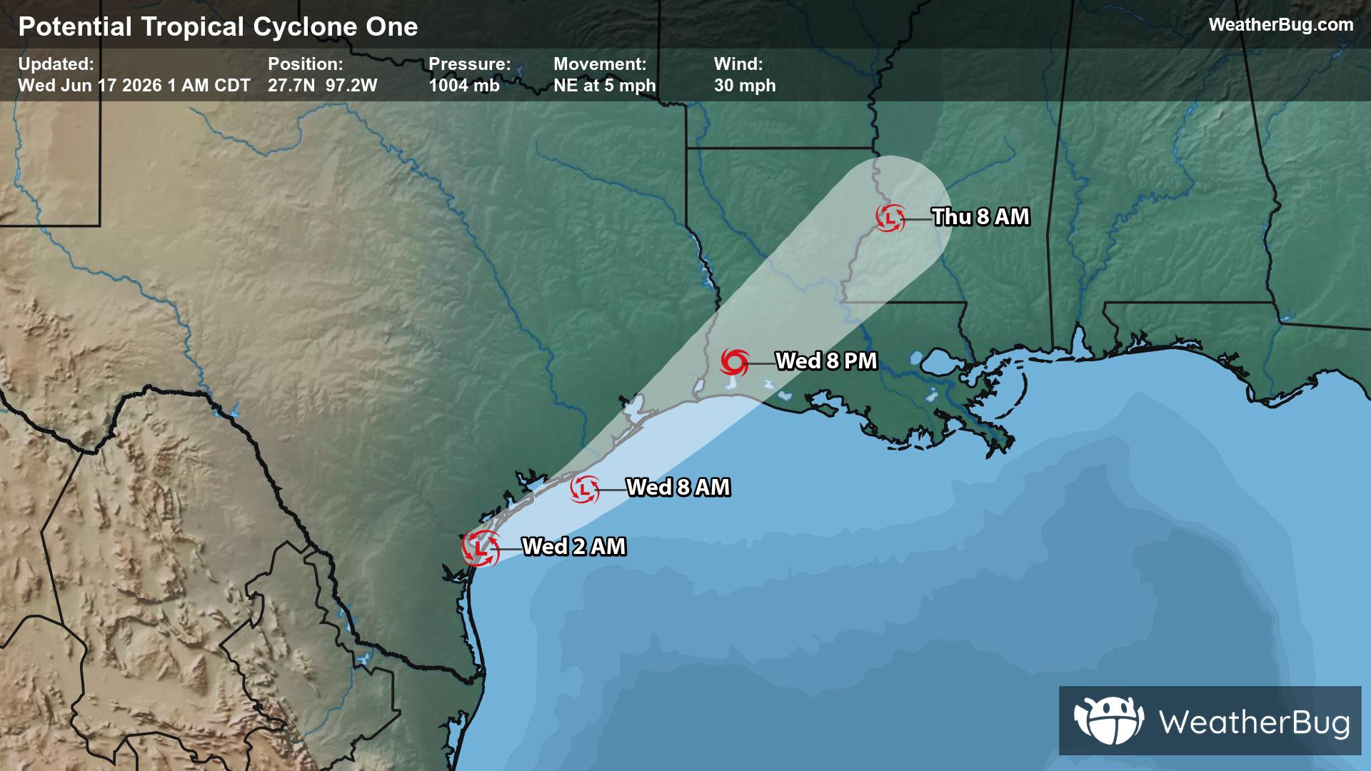
Kerby, OR Weather

As of

Weather Station:WeatherBug

Open weather station selector modal

45degrees Fahrenheit

Feels like:39°F

Hi: 51Lo: 29

80% Chance of Light Rain

Live Weather Radar

Kerby, OR weather radar map

Current Weather Details

Windchill
39°
Daily Rain
--"
Dew point
41°
Monthly Rain
1.61"
Humidity
90%
Avg. Wind
S 7 mph
Pressure
--"
Wind Gust
-- mph
Sunrise
6:34 AM
Moon
Waning Crescent
Sunset
7:55 PM
UV Index
2 (Low)

Weather Forecast

  • Today

    Hi

    Becoming partly cloudy late this afternoon. Rain this morning. Slight chance of snow through the day. Chance of rain and slight chance of thunderstorms this afternoon. Snow level 3500 feet lowering to 2500 feet this afternoon. No snow accumulation. Highs in the mid 40s to lower 50s. Southwest winds 10 to 20 mph shifting to the west 10 to 15 mph this afternoon. Chance of precipitation near 100 percent.

  • Tonight

    Lo

    Mostly cloudy. Chance of rain showers snow showers and slight chance of thunderstorms in the evening then slight chance of rain and snow after midnight. Snow level 2000 feet in the evening. Lows in the lower to mid 30s. Northwest winds 5 to 10 mph. Chance of precipitation 30 percent.

Kerby, OR 10-day weather forecast

AIR QUALITY

21 | Fair

Top Triggers:pm25
Air quality data provided by Ambee
View Today's Air Quality details for Kerby, OR

POLLEN COUNT & ALLERGY FORECAST

2.9 Low-Medium

Predominant Pollen:Oak, Mulberry and Ash.
View the Pollen forecast details

LIGHTNING MAP

Closest strike in the last 30 minutes:1305.4 miles

No Lightning Nearby

Real-time lightning alerts & live Map