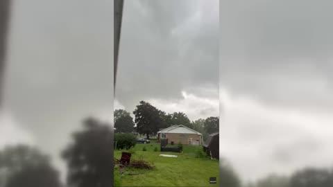
Kewanee, IL Weather

As of

Weather Station:WeatherBug

Open weather station selector modal

16degrees Fahrenheit

Feels like:1°F

Hi: --Lo: 15

Partly Cloudy

Live Weather Radar

Kewanee, IL weather radar map

Current Weather Details

Windchill
--
Daily Rain
--
Dew point
--
Monthly Rain
--
Humidity
--
Avg. Wind
--
Pressure
--
Wind Gust
--
Sunrise
7:22 AM
Moon
Waning Crescent
Sunset
4:57 PM
UV Index
1 (Low)

Weather Forecast

  • Tonight

    Lo

    Mostly cloudy. Low temperature around 15F. Dew point will be around 11F with an average humidity of 57%. Winds will be 14 mph from the NW.

  • Tomorrow

    Hi

    Partly sunny early this morning then cloudy with snow this afternoon. Snow accumulation up to 1 inch. Much cooler. Near steady temperature 15 to 20. West winds 15 to 20 mph with gusts up to 30 mph. Chance of snow 90 percent. Wind chill values as low as 5 below.

Kewanee, IL 10-day weather forecast

AIR QUALITY

13 | Excellent

Top Triggers:pm25
Air quality data provided by Ambee
View Today's Air Quality details for Kewanee, IL

POLLEN COUNT & ALLERGY FORECAST

0.1 Low

Predominant Pollen:None
View the Pollen forecast details

LIGHTNING MAP

Closest strike in the last 30 minutes:1869.1 miles

No Lightning Nearby

Real-time lightning alerts & live Map