Severe Weather Outbreak Targets the Midwest
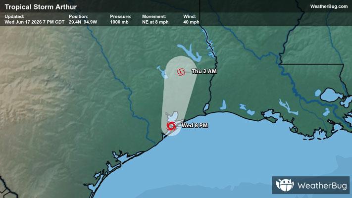
The Mississippi Valley remains abloom with severe thunderstorms this evening, with the threat stretching from Minnesota to Missouri and even along the Gulf Coast.
Read More
62degrees Fahrenheit

Feels like:62°
Hi:64°Lo:60°
50% Chance Rain Showers
Lo

Cloudy. Chance of thunderstorms in the evening. Light rain showers through around midnight then chance of light rain showers after midnight. Lows in the mid 50s. Southwest winds 5 to 10 mph shifting to the northwest 10 to 15 mph after midnight. Chance of precipitation 90 percent.
Hi

Partly sunny. A 20 percent chance of light rain showers late in the afternoon. Highs in the lower 70s. Northwest winds 10 to 15 mph.


Closest strike in the last 30 minutes:16.2 miles
Storms Approaching