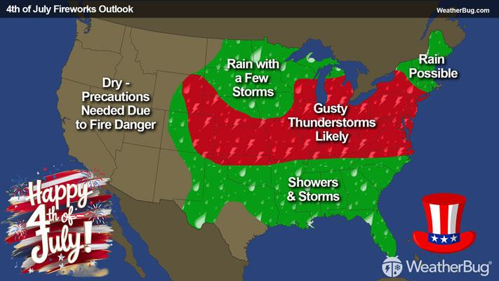
Upper Midwest, Appalachia to Spark Severe Storms
Storm systems moving across the Northern Tier will provide chances for severe thunderstorms in multiple regions today.
Read More
87degrees Fahrenheit

Feels like:92°
Hi:92°Lo:73°
Mostly Sunny
Hi

Mostly sunny with scattered showers and thunderstorms. Heat index readings 95 to 98. Southwest winds 10 to 15 mph. Chance of precipitation 40 percent.
Lo

Numerous thunderstorms through around midnight. Showers through the night. Scattered thunderstorms after midnight. Lows around 70. Southwest winds 5 to 10 mph. Chance of precipitation 80 percent.


Closest strike in the last 30 minutes:7.0 miles
Stay Alert!