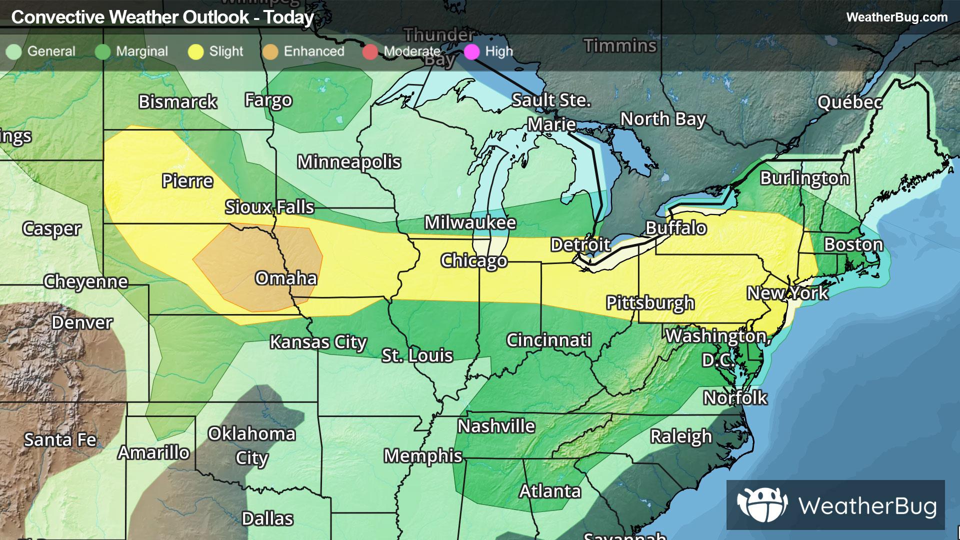
Severe Weather Stretches from High Plains to Northeast
Another round of severe weather will occur from the central and northern Plains through the Midwest and into Northeast today.
Read More
101degrees Fahrenheit

Feels like:111°
Hi:101°Lo:80°
Hot and Humid
Hi

Sunny with isolated showers and thunderstorms. Some thunderstorms may produce damaging winds. Hot. Near steady temperature around 102. West winds 10 to 15 mph with gusts up to 25 mph. Chance of rain 20 percent. Heat index values up to 111.
Lo

Mostly cloudy with scattered showers and thunderstorms in the evening then partly cloudy after midnight. Some thunderstorms may produce damaging winds in the evening. Humid with lows in the upper 70s. West winds 10 to 15 mph becoming northwest around 5 mph after midnight. Chance of rain 40 percent. Heat index values up to 108 early in the evening.


Closest strike in the last 30 minutes:159.7 miles
No Lightning Nearby


