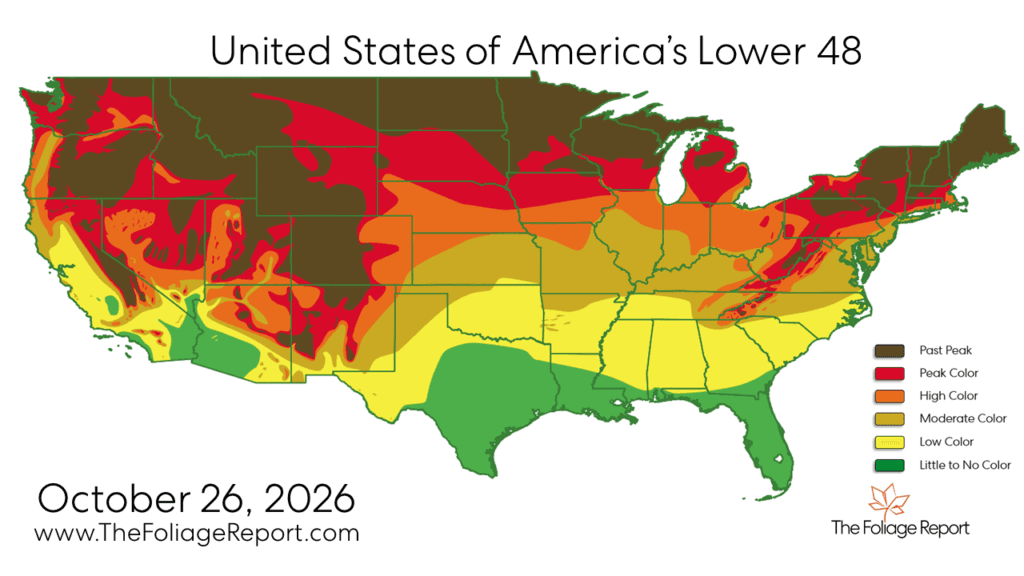
2026 Fall Foliage Report: Where Colors Are Peaking Now
Peak color is shifting south, while the fall foliage season begins to fade across the northern U.S.
Read More
52degrees Fahrenheit

Feels like:52°
Hi:55°Lo:42°
50% Chance Rain Showers
Hi

Cloudy with probable rain. Chance of precipitation 65%. High temperature around 55F. Dew point will be around 42F with an average humidity of 67%. Winds will be 5 mph from the ESE.
Lo

Mostly cloudy. A chance of rain showers in the evening, then a chance of rain overnight. Lows in the upper 30s to lower 40s. Southwest wind 5 to 15 mph overnight. Gusts up to 35 mph. Chance of precipitation 50 percent. Rainfall amounts less than a tenth of an inch.


Closest strike in the last 30 minutes:1369.6 miles
No Lightning Nearby


Peak color is shifting south, while the fall foliage season begins to fade across the northern U.S.