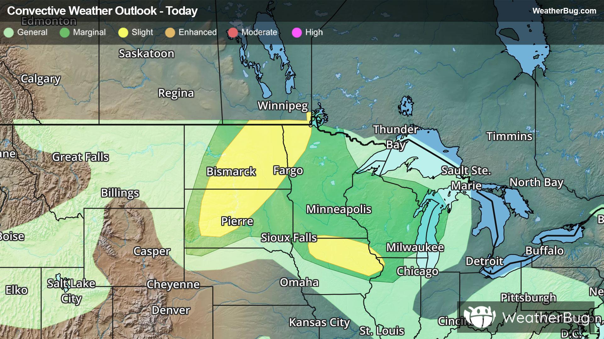
Lewiston, MI Weather

As of

Weather Station:GRAYLING AF

Open weather station selector modal

27degrees Fahrenheit

Feels like:18°F

Hi: 29Lo: 14

70% Chance of Heavy Snow

Live Weather Radar

Lewiston, MI weather radar map

Current Weather Details

Windchill
--
Daily Rain
--
Dew point
--
Monthly Rain
--
Humidity
--
Avg. Wind
--
Pressure
--
Wind Gust
--
Sunrise
8:10 AM
Moon
Waning Crescent
Sunset
5:24 PM
UV Index
1 (Low)

Weather Forecast

  • Today

    Hi

    Mostly cloudy. Chance of snow showers and slight chance of light freezing drizzle early then snow showers likely and slight chance of light freezing drizzle in the afternoon. Little or no snow accumulation. Highs around 30. Southwest winds 5 to 10 mph with gusts to around 20 mph. Chance of precipitation 70 percent.

  • Tonight

    Lo

    Mostly cloudy with chance of snow showers early then partly cloudy with slight chance of snow showers after midnight. Lows around 14. West winds up to 10 mph. Gusts up to 20 mph early. Chance of snow 50 percent.

Lewiston, MI 10-day weather forecast

AIR QUALITY

19 | Excellent

Top Triggers:pm25
Air quality data provided by Ambee
View Today's Air Quality details for Lewiston, MI

POLLEN COUNT & ALLERGY FORECAST

0.1 Low

Predominant Pollen:None
View the Pollen forecast details

LIGHTNING MAP

Closest strike in the last 30 minutes:2052.8 miles

No Lightning Nearby

Real-time lightning alerts & live Map