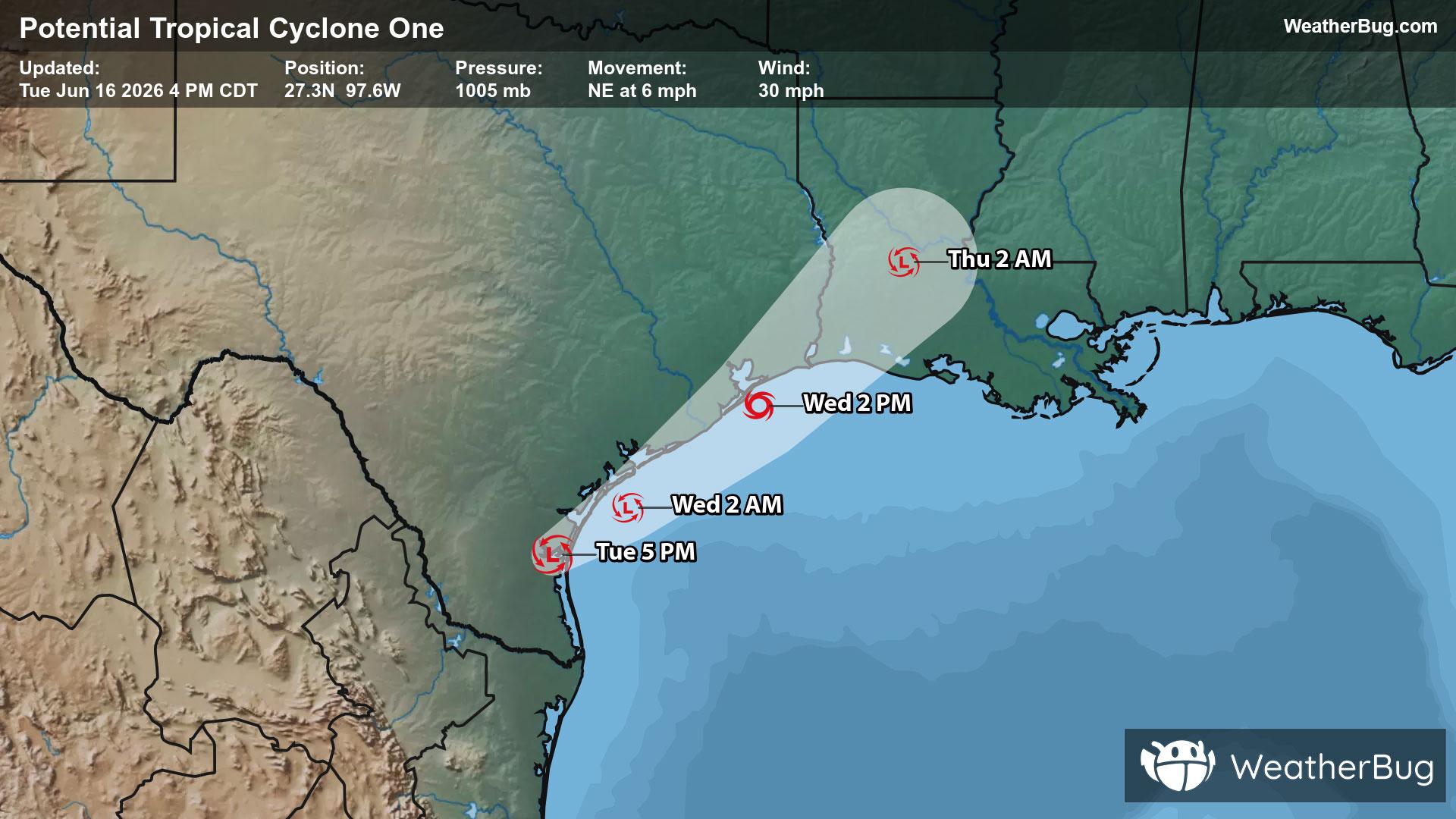
Potential Tropical Cyclone One May Become Atlantic's First Named Storm
A disorganized Potential Tropical Cyclone One may become the Atlantic season's first named storm on Wednesday.
Read More

Mostly Sunny
Hi

Partly cloudy with a chance of rain. Chance of precipitation 50%. High temperature around 78F. Dew point will be around 53F with an average humidity of 57%. Winds will be 8 mph from the NW.
Lo

Partly cloudy. Lows in the mid 60s. Northwest winds 5 to 10 mph becoming northeast this evening then increasing to south 10 to 15 mph with gusts up to 30 mph after midnight.


Closest strike in the last 30 minutes:203.3 miles
No Lightning Nearby
A disorganized Potential Tropical Cyclone One may become the Atlantic season's first named storm on Wednesday.


