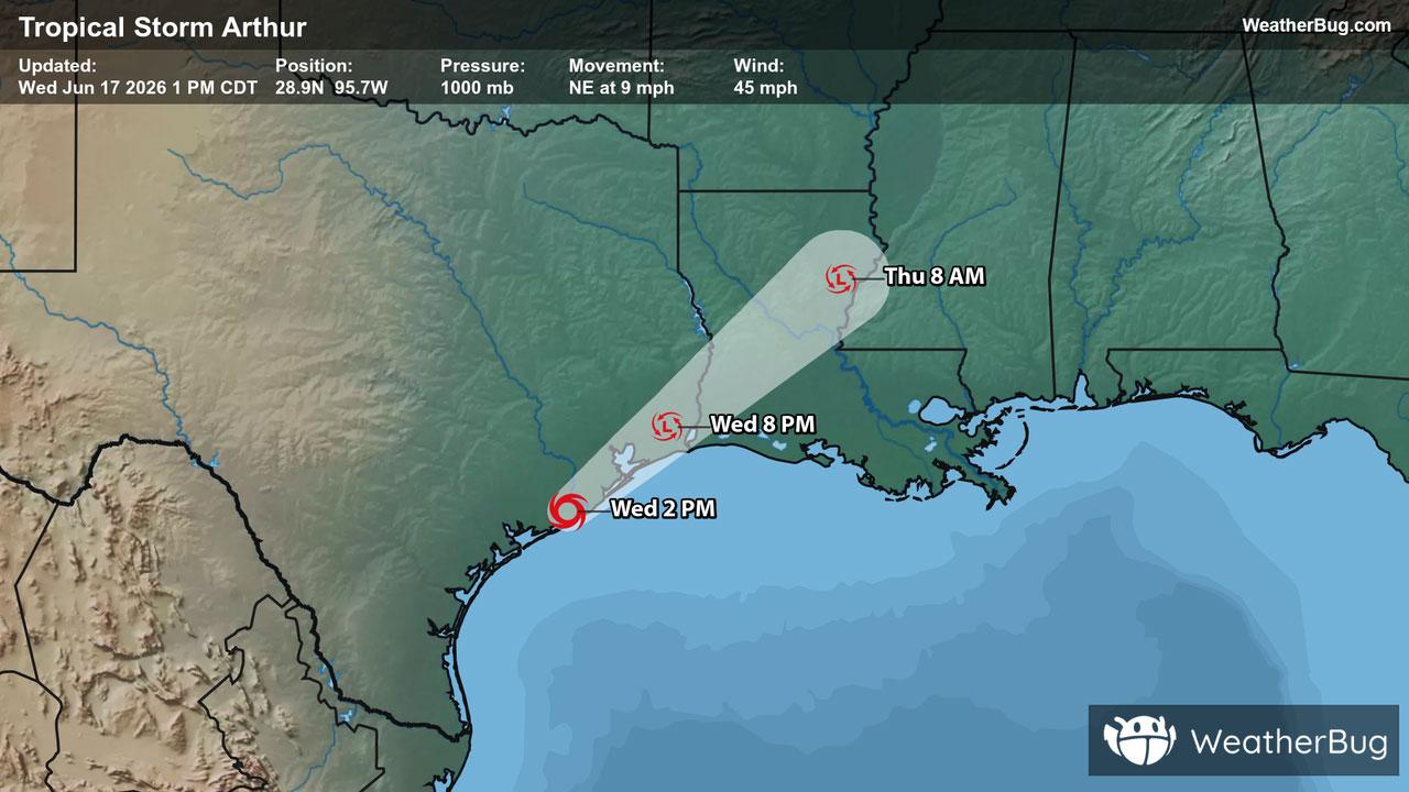
Severe Weather Outbreak Targets the Midwest
An outbreak of severe weather is expected across the Midwest today, including the risk for intense tornadoes.
Read More

Partly Cloudy
Hi

Partly cloudy with a slight chance of rain. Chance of precipitation 30%. High temperature around 72F. Dew point will be around 50F with an average humidity of 65%. Winds will be 4 mph from the S.
Lo

Partly cloudy with a slight chance of showers and thunderstorms until midnight then cloudy with showers likely after midnight. Lows in the mid 50s. Light and variable winds becoming south around 10 mph with gusts up to 25 mph after midnight. Chance of rain 60 percent.

Closest strike in the last 30 minutes:27.9 miles
Monitor Storms
An outbreak of severe weather is expected across the Midwest today, including the risk for intense tornadoes.