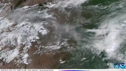
Manton, MI

Weather

As of
Current Temperature

64degrees Fahrenheit

Feels like:64°

Hi:70°Lo:54°

Mostly Sunny

Live Weather Radar

Manton, MI weather radar map

Current Weather Details

Windchill
64°
Daily Rain
0"
Dew point
55°
Monthly Rain
3.76"
Humidity
73%
Avg. Wind
E 3 mph
Pressure
30.09" →
Wind Gust
3 mph
Sunrise
5:58 AM
Moon
Waxing Gibbous
Sunset
9:30 PM
UV Index
6 (High)

Weather Forecast

  • Tonight

    Lo

    Mostly clear. Patchy fog after midnight. Lows in the lower 50s. Light winds.

  • Tomorrow

    Hi

    Mostly sunny. Patchy fog early. Highs in the upper 70s. Light winds.

Manton, MI 10-day weather forecast

AIR QUALITY

Air Quality Index
24|Fair
Top Triggers:
pm25
View Today's Air Quality details for Manton, MI

POLLEN COUNT & ALLERGY FORECAST

Pollen Count
5|Medium
Predominant Pollen:
Grass, Sorrel/Dock, Plantain
Manton, MI Pollen forecast details

LIGHTNING MAP

Closest strike in the last 30 minutes:397.6 miles

No Lightning Nearby

Manton, MI real-time lightning alerts & live Map