Potential Tropical Cyclone One May Become Atlantic's First Named Storm
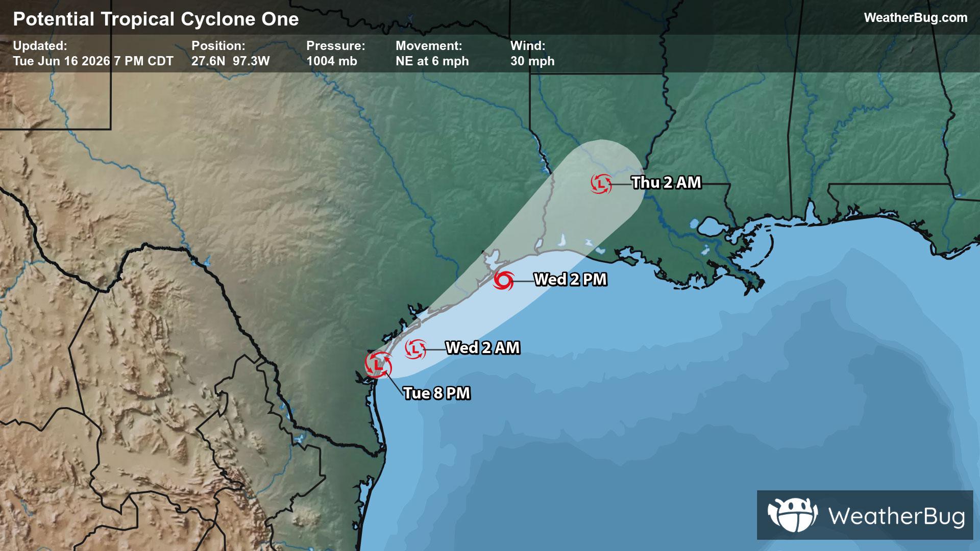
A disorganized Potential Tropical Cyclone One may become the Atlantic season's first named storm on Wednesday.
Read More

Sunny
Lo

Mostly cloudy. Lows in the mid 50s. West winds 10 to 15 mph becoming southwest around 5 mph after midnight.
Hi

A slight chance of thunderstorms in the morning. Showers. Thunderstorms likely in the afternoon. Some thunderstorms may be severe in the afternoon. Locally heavy rainfall possible in the afternoon. Breezy with highs around 70. South winds 10 to 15 mph increasing to 15 to 20 mph in the afternoon. Gusts up to 30 mph. Chance of precipitation near 100 percent.


Closest strike in the last 30 minutes:134.6 miles
No Lightning Nearby
A disorganized Potential Tropical Cyclone One may become the Atlantic season's first named storm on Wednesday.


