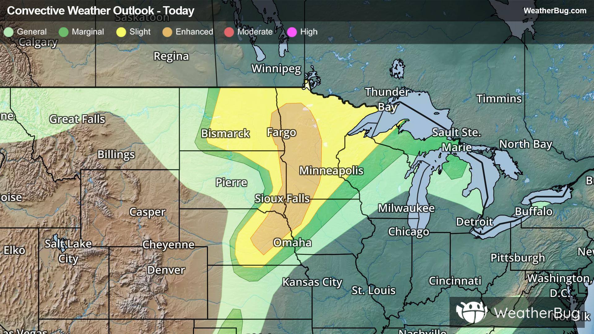
Dangerous Storms Underway For Northern Plains & Upper Midwest
A strengthening low pressure system will produce severe weather across the northern Plains and Upper Midwest tonight.
Read More
72degrees Fahrenheit

Feels like:72°
Hi:80°Lo:72°
Mostly Clear
Lo

Mostly cloudy with a slight chance of thunderstorms. A slight chance of showers early this evening then a chance of showers. Patchy fog. Warm. Near steady temperature in the lower 70s. South winds 5 to 10 mph. Chance of rain 50 percent.
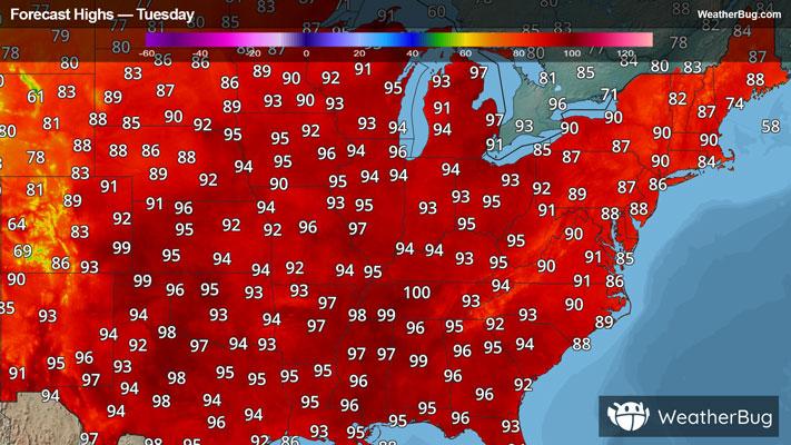
Hi

Hot. Mostly cloudy with a chance of showers. A slight chance of thunderstorms in the morning then a chance of thunderstorms in the afternoon. Some thunderstorms may be severe. Some thunderstorms may be severe. Highs around 95. Southwest winds 5 to 15 mph with gusts up to 25 mph. Chance of rain 50 percent.

Closest strike in the last 30 minutes:177.6 miles
No Lightning Nearby
A strengthening low pressure system will produce severe weather across the northern Plains and Upper Midwest tonight.