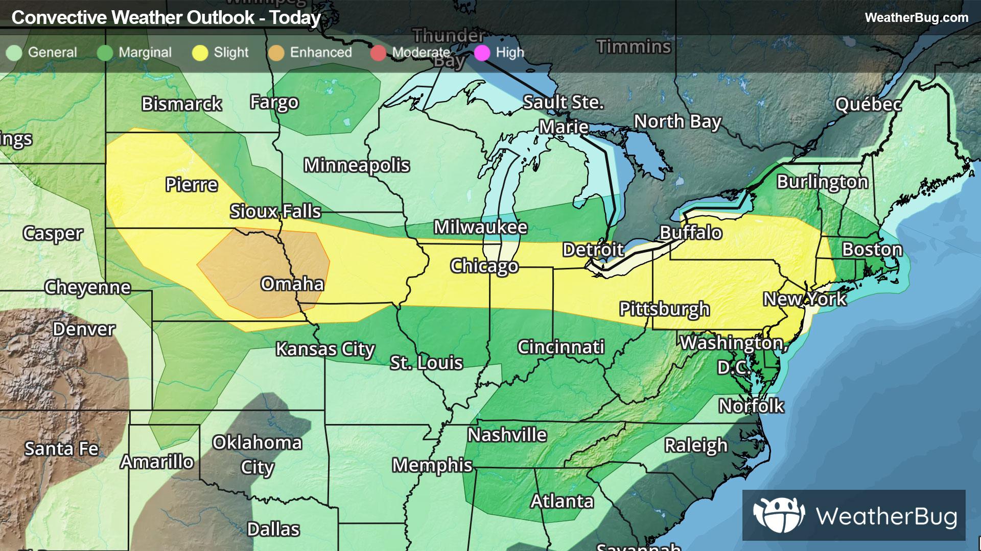
Severe Weather Stretches from High Plains to Northeast
Another round of severe weather will occur from the central and northern Plains through the Midwest and into Northeast today.
Read More
79degrees Fahrenheit

Feels like:79°
Hi:85°Lo:64°
Partly Cloudy
Hi

Partly sunny with a 20 percent chance of light showers and thunderstorms. Some thunderstorms may be severe with damaging winds and large hail. Near steady temperature in the lower 80s. West winds 5 to 10 mph.
Lo

Mostly cloudy. Slight chance of thunderstorms in the evening. Chance of light showers through the night. Slight chance of thunderstorms after midnight. Patchy fog early in the morning. Lows in the upper 60s. Southwest winds up to 5 mph through around midnight becoming calm. Chance of precipitation 30 percent.


Closest strike in the last 30 minutes:27.1 miles
Monitor Storms


