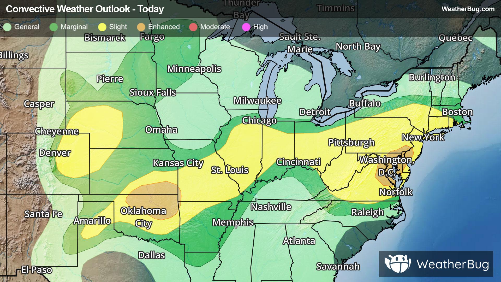
Storms Resurge in Mid-Atlantic, High Plains
Severe storms will return to both the High Plains and Mid-Atlantic this afternoon and evening when heated air masses ignite.
Read More
67degrees Fahrenheit

Feels like:67°
Hi:77°Lo:62°
Partly Cloudy
Hi

Humid. Partly sunny with a slight chance of showers. Nearly steady temperature in the upper 70s. Northeast wind 10 to 15 mph. Chance of rain 20 percent.
Lo

Mostly cloudy. Lows in the lower 60s. Northeast wind 5 to 10 mph.


Closest strike in the last 30 minutes:125.0 miles
No Lightning Nearby
Severe storms will return to both the High Plains and Mid-Atlantic this afternoon and evening when heated air masses ignite.


