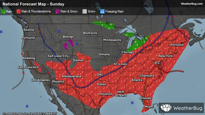
Severe Storms To Strike The Northeast Down Into The Southeast
Strong to severe thunderstorms are likely to develop across the Northeast, Mid-Atlantic and parts of the Southeast later this afternoon and evening leading to travel delays.
Read More

70% Chance of Light Rain
Hi

Showers and a chance of thunderstorms in the late morning and early afternoon then scattered showers and a slight chance of thunderstorms in the late afternoon. Highs in the lower 70s. Northwest winds 5 to 15 mph. Gusts up to 30 mph in the afternoon. Chance of rain 90 percent.
Lo

Partly cloudy in the evening then clearing. Lows in the upper 40s. West winds 5 to 10 mph. Gusts up to 25 mph in the evening.


Closest strike in the last 30 minutes:62.7 miles
No Lightning Nearby