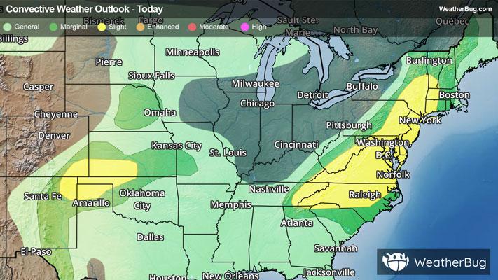
Severe Weather Sweeps East Coast, High Plains
Severe weather ignites today from both an intense cold front from Georgia to Vermont as well as daytime heating in the southern High Plains.
Read More

Mostly Sunny
Lo

Partly cloudy this evening then mostly cloudy with a chance of showers and thunderstorms after midnight. Lows in the lower 70s. South winds 5 to 10 mph. Chance of rain 30 percent.
Hi

Partly sunny with a slight chance of showers and thunderstorms in the morning then sunny with a chance of showers and thunderstorms in the afternoon. Highs around 90. South winds 10 to 15 mph with gusts up to 25 mph. Chance of rain 40 percent. Heat index values up to 103.


Closest strike in the last 30 minutes:283.2 miles
No Lightning Nearby


