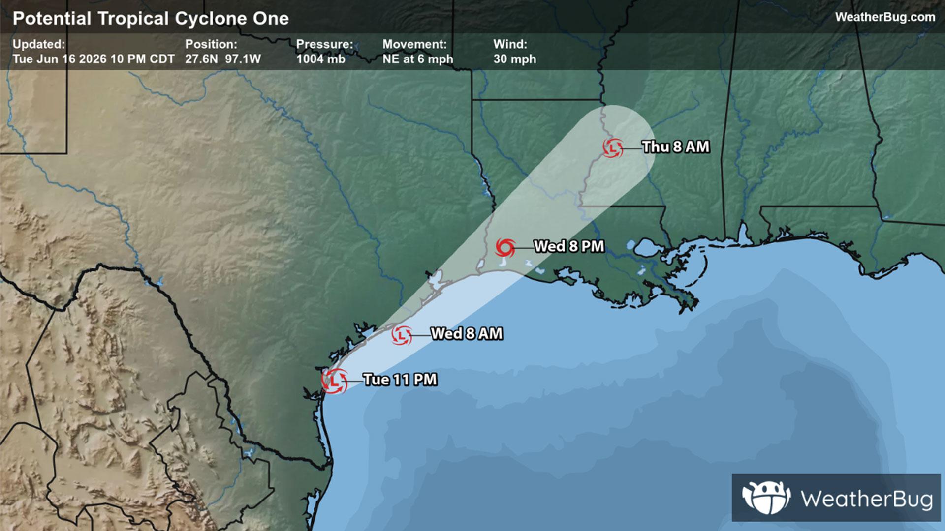
Potential Tropical Cyclone One May Become Atlantic's First Named Storm
A disorganized Potential Tropical Cyclone One may become the Atlantic season's first named storm on Wednesday.
Read More

Partly Cloudy
Lo

Clear late this evening then becoming partly cloudy. Lows in the lower 50s. Light and variable winds.
Hi

Mostly sunny. A chance of showers and thunderstorms in the afternoon. Highs in the upper 70s. South winds around 5 mph. Chance of rain 40 percent.


Closest strike in the last 30 minutes:186.2 miles
No Lightning Nearby
A disorganized Potential Tropical Cyclone One may become the Atlantic season's first named storm on Wednesday.


