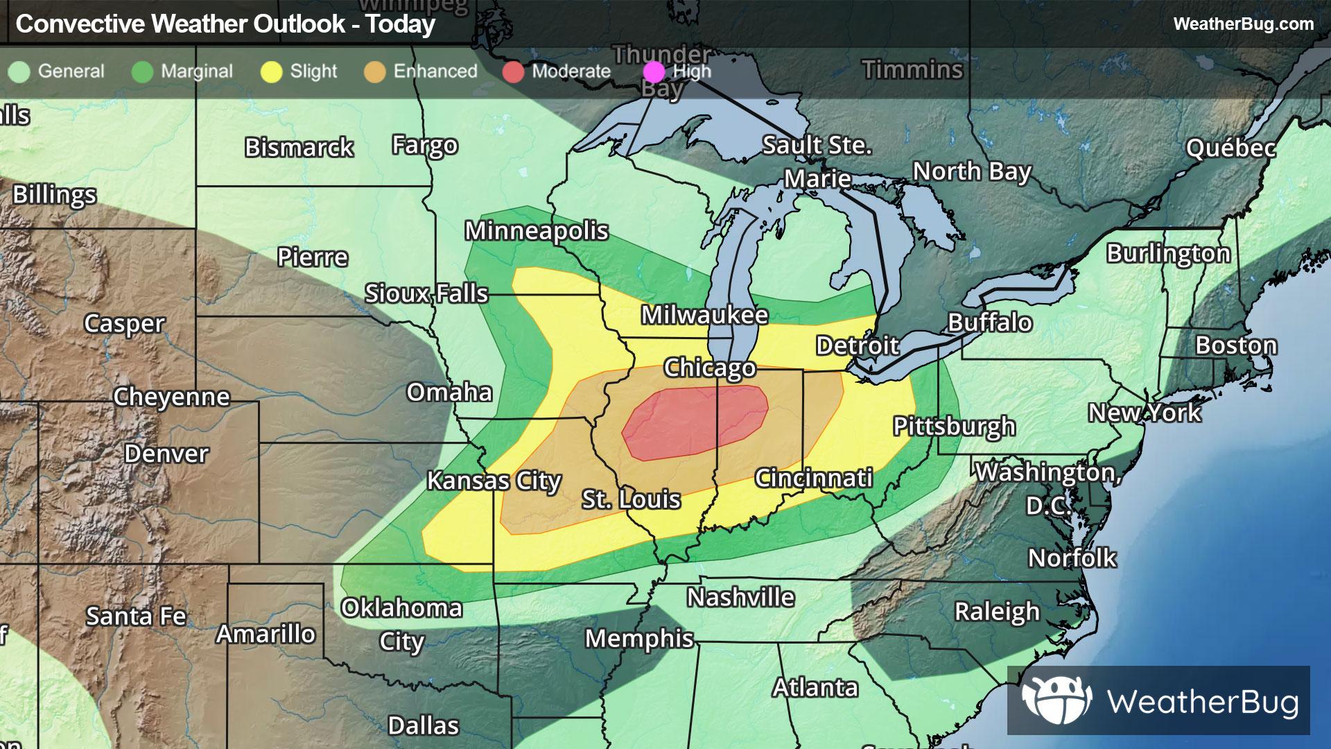
Petaca, NM

Weather

As of
Current Temperature
46
Feels like:46°
Today's high temperature
--
Today's low temperature
45°

70% Chance Rain Showers

Live Weather Radar

Petaca, NM weather radar map

Current Weather Details

Windchill
46°
Daily Rain
--"
Dew point
46°
Monthly Rain
0.1"
Humidity
100%
Avg. Wind
SSW 2 mph
Pressure
--"
Wind Gust
-- mph
Sunrise
5:45 AM
Moon
New
Sunset
8:24 PM
UV Index
11 (Extreme)

Weather Forecast

  • Tonight

    Lo

    Scattered thunderstorms in the evening. Partly cloudy with scattered showers. Lows in the mid 40s. Northeast winds around 15 mph in the evening. Chance of rain 50 percent.

  • Tomorrow

    Hi

    Mostly sunny in the morning then becoming partly cloudy. Scattered showers. Isolated thunderstorms in the morning then scattered thunderstorms in the afternoon. Highs in the lower 70s. West winds 15 to 20 mph. Chance of rain 50 percent.

Petaca, NM 10-day weather forecast

AIR QUALITY

Air Quality Index
29|Fair
Top Triggers:
pm25
View Today's Air Quality details for Petaca, NM

POLLEN COUNT & ALLERGY FORECAST

Pollen Count
6.5|Medium
Predominant Pollen:
Grass, Chenopods, Oak
Petaca, NM Pollen forecast details

LIGHTNING MAP

Closest strike in the last 30 minutes:268.4 miles

No Lightning Nearby

Petaca, NM real-time lightning alerts & live Map