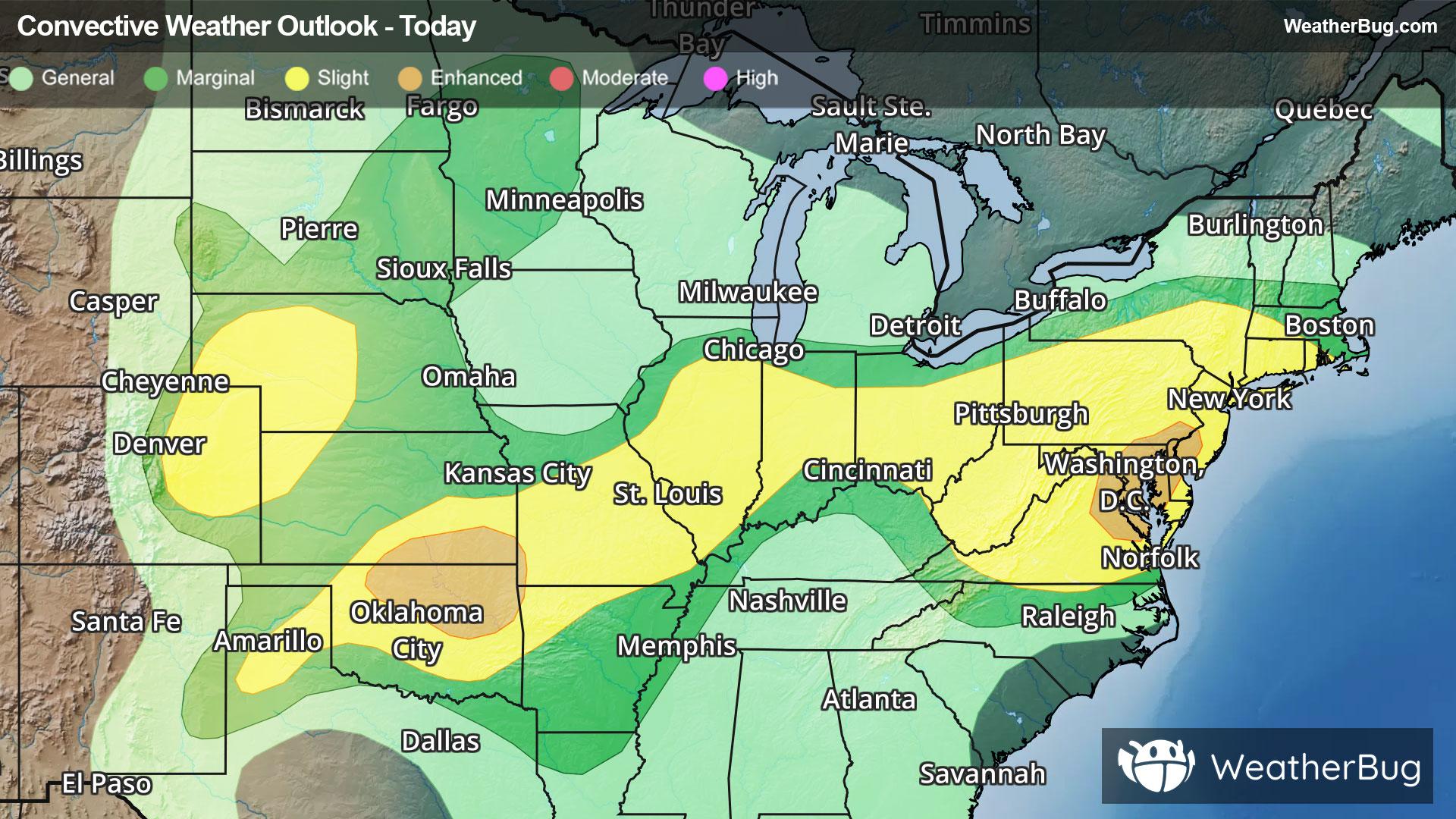
Storms Resurge in Mid-Atlantic, High Plains
Severe storms will rumble across the High Plains and Mid-Atlantic this evening when heated air masses ignite.
Read More
83degrees Fahrenheit

Feels like:87°
Hi:86°Lo:70°
70% Chance Rain Showers
Lo

Partly cloudy with probable rain. Chance of precipitation 65%. Low temperature around 69F. Dew point will be around 70F with an average humidity of 82%. Winds will be 4 mph from the NE.
Hi

Mostly cloudy with scattered showers and thunderstorms early then partly cloudy with numerous showers and scattered thunderstorms in the late afternoon. Heat index readings heat index slowly falling from 90. West winds 5 to 10 mph. Chance of rain 60 percent.


Closest strike in the last 30 minutes:71.9 miles
No Lightning Nearby
Severe storms will rumble across the High Plains and Mid-Atlantic this evening when heated air masses ignite.


