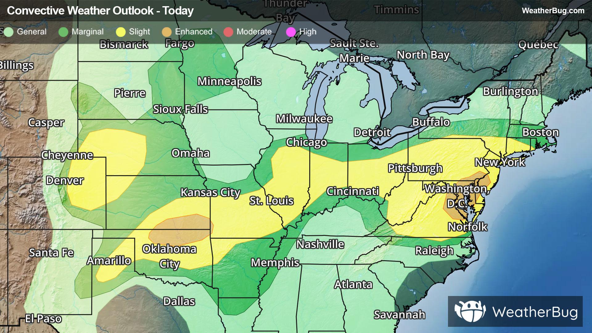
Storms Resurge in Mid-Atlantic, High Plains
Severe storms will return to both the High Plains and Mid-Atlantic this afternoon and evening when heated air masses ignite.
Read More
83degrees Fahrenheit

Feels like:87°
Hi:83°Lo:68°
30% Chance Rain Showers
Hi

Showers and thunderstorms likely. Some thunderstorms may produce small hail. Highs in the mid 80s. Northwest winds 5 to 10 mph with gusts up to 20 mph. Chance of rain 70 percent.
Lo

Partly cloudy. Showers likely with a chance of thunderstorms in the evening then a chance of showers with a slight chance of thunderstorms after midnight. Patchy fog after midnight. Some thunderstorms may produce small hail in the evening. Lows in the lower 60s. North winds around 5 mph in the evening becoming light and variable. Chance of rain 70 percent.


Closest strike in the last 30 minutes:49.6 miles
No Lightning Nearby
Severe storms will return to both the High Plains and Mid-Atlantic this afternoon and evening when heated air masses ignite.


