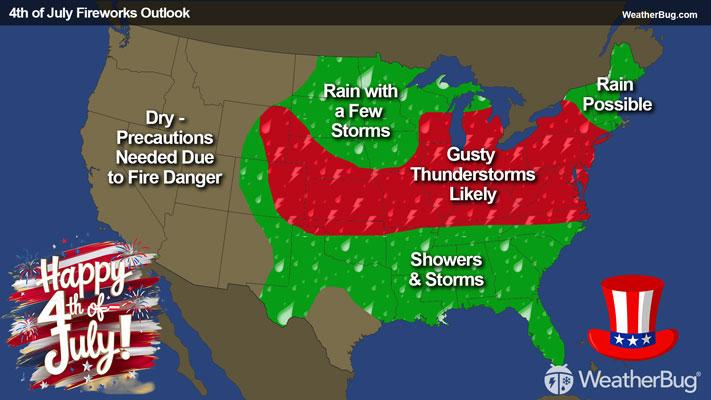
Upper Midwest, Appalachia to Spark Severe Storms
Storm systems moving across the Northern Tier will provide chances for severe thunderstorms in multiple regions today.
Read More
73degrees Fahrenheit

Feels like:73°
Hi:78°Lo:69°
70% Chance Rain Showers
Hi

Partly cloudy with probable rain. Chance of precipitation 65%. High temperature around 78F. Dew point will be around 71F with an average humidity of 83%. Winds will be 4 mph from the S.
Lo

Mostly cloudy. Showers likely early in the evening. Chance of thunderstorms in the evening then chance of showers and slight chance of thunderstorms after midnight. Some thunderstorms may produce heavy rainfall. Lows in the mid 60s. South winds up to 5 mph. Chance of precipitation 60 percent.

Closest strike in the last 30 minutes:92.4 miles
No Lightning Nearby