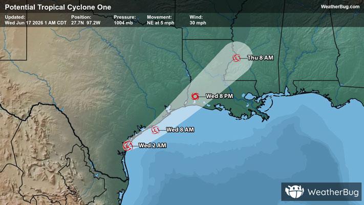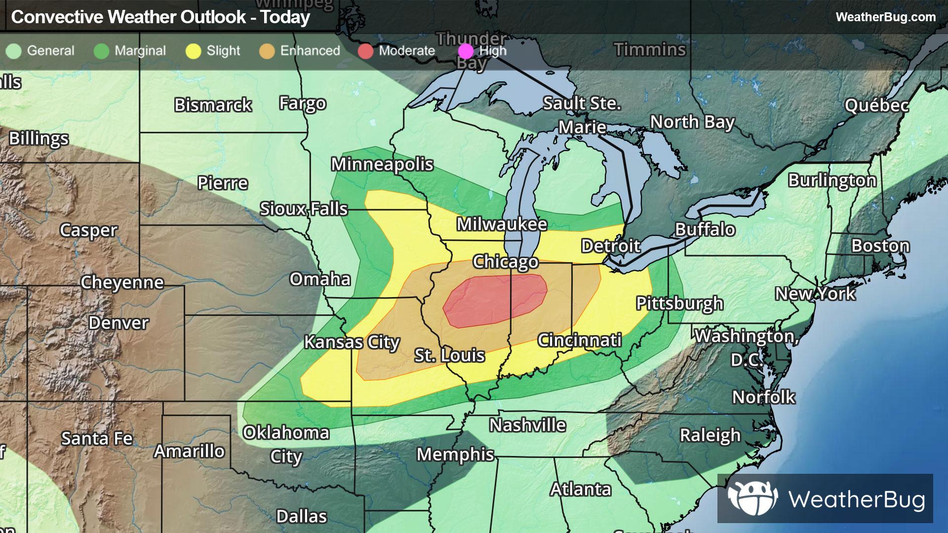
Severe Weather Outbreak Targets the Midwest
An outbreak of severe weather is expected across the Midwest today, including the risk for intense tornadoes.
Read More

70% Chance of Light Rain
Lo

Mostly cloudy. A slight chance of showers and thunderstorms in the evening then showers with a chance of thunderstorms after midnight. Some thunderstorms may produce heavy rainfall. Humid. Near steady temperature in the upper 70s. Southeast winds 5 to 10 mph. Chance of rain 80 percent.
Hi

Mostly cloudy. A chance of showers and thunderstorms in the morning then showers and thunderstorms likely in the afternoon. Some thunderstorms may produce heavy rainfall. Very windy and humid with highs in the mid 80s. South winds 10 to 15 mph with gusts up to 25 mph increasing to 25 to 35 mph with gusts up to 45 mph in the afternoon. Chance of rain 70 percent.


Closest strike in the last 30 minutes:229.0 miles
No Lightning Nearby
An outbreak of severe weather is expected across the Midwest today, including the risk for intense tornadoes.