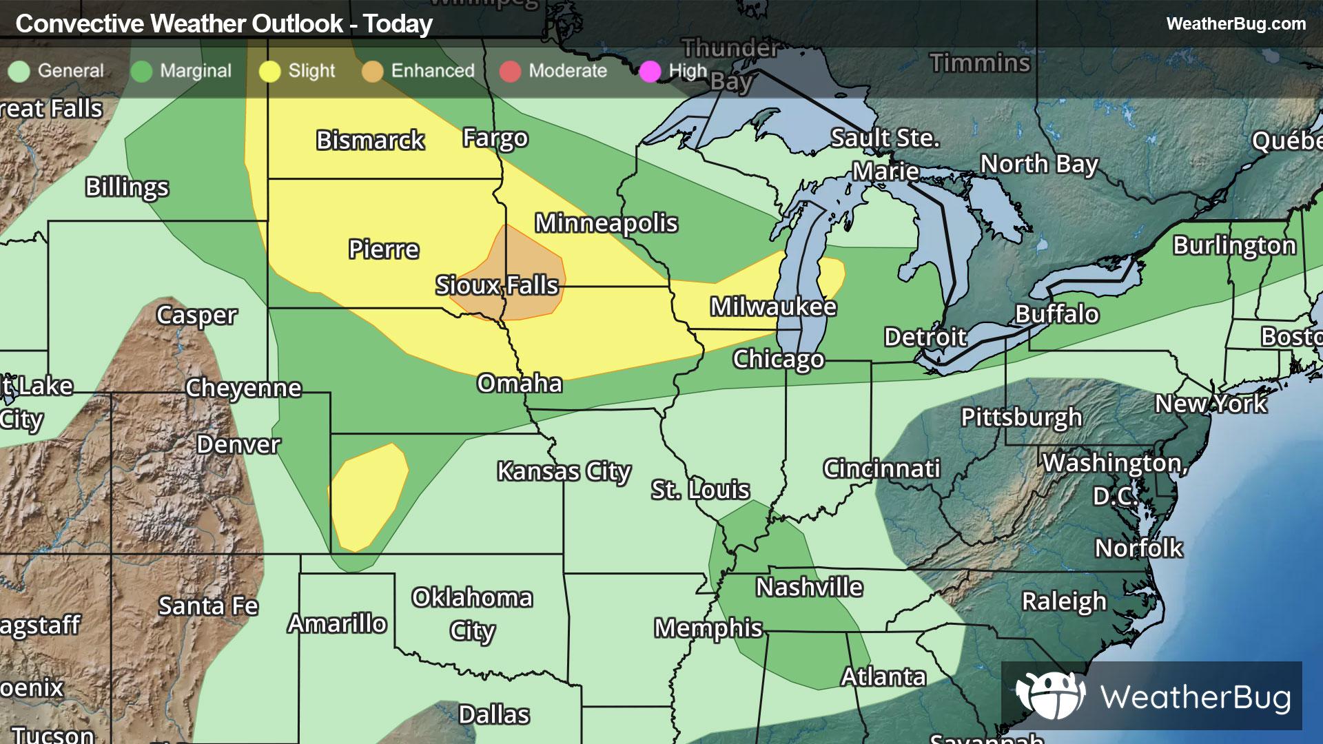
Upper Midwest, Appalachia to Spark Severe Storms
Storm systems moving across the Northern Tier will provide chances for severe thunderstorms in multiple regions today.
Read More
80degrees Fahrenheit

Feels like:85°
Hi:87°Lo:75°
Hazy
Lo

Mostly clear. Lows in the upper 70s. Southwest winds 10 to 15 mph. Heat index values up to 108 early this evening.
Hi

Sunny. A slight chance of showers and thunderstorms in the afternoon. Hot with highs around 100. West winds 5 to 10 mph. Chance of rain 20 percent. Heat index values up to 111.


Closest strike in the last 30 minutes:289.6 miles
No Lightning Nearby


