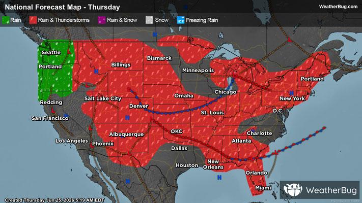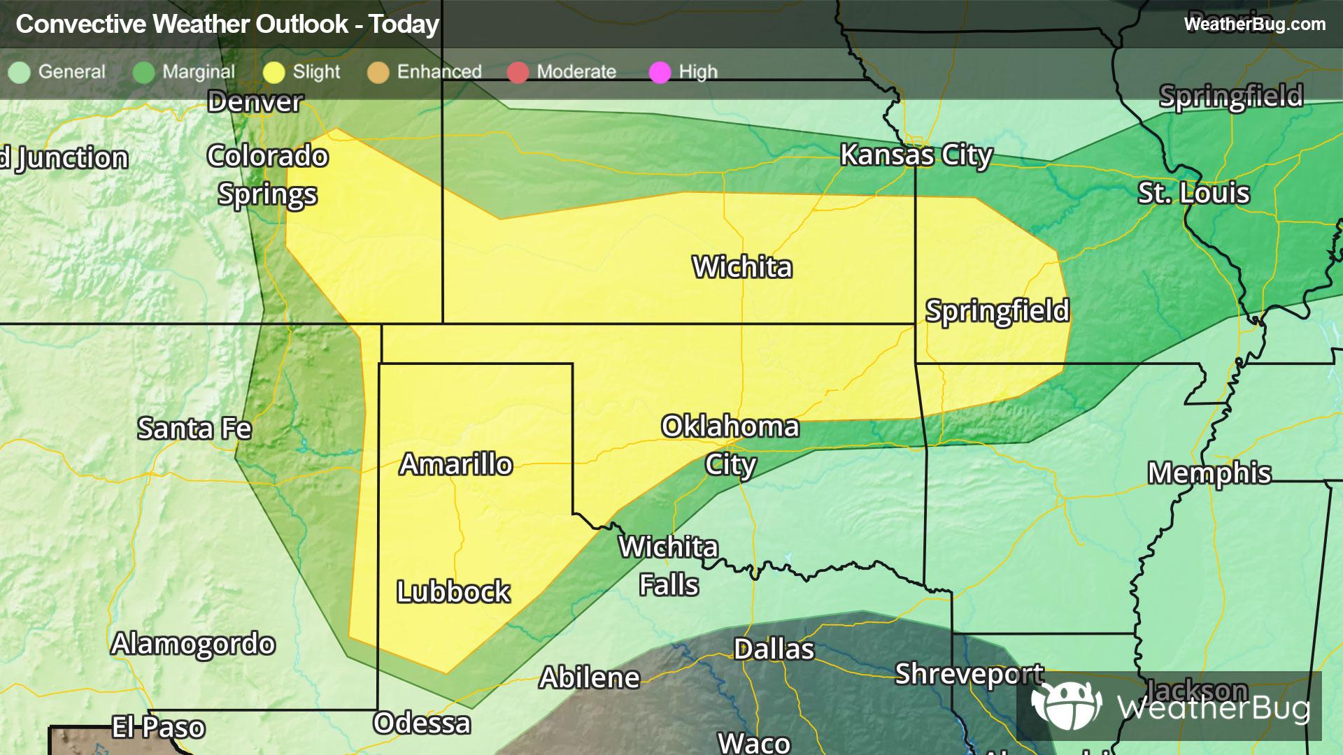
Central & Southern Plains Under Severe Threat
A low pressure system tracking across the central U.S. will produce severe thunderstorms over the southern Plains today.
Read More
68degrees Fahrenheit

Feels like:68°
Hi:72°Lo:68°
30% Chance of Light Rain
Lo

Partly cloudy with a slight chance of rain. Chance of precipitation 30%. Low temperature around 68F. Dew point will be around 65F with an average humidity of 89%. Winds will be 2 mph from the N.
Hi

Cloudy with scattered showers and thunderstorms. Highs in the mid 70s. Northeast winds 5 to 10 mph. Chance of rain 50 percent.

Closest strike in the last 30 minutes:213.7 miles
No Lightning Nearby