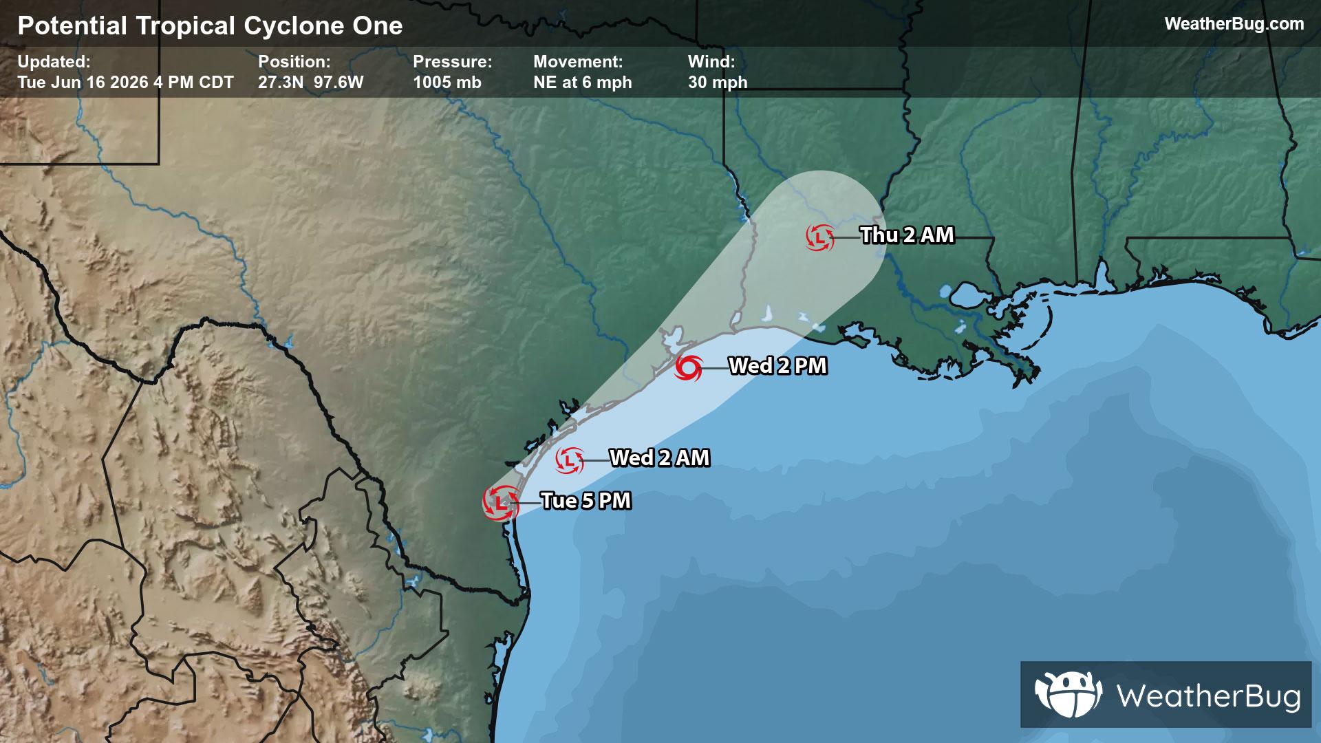
Potential Tropical Cyclone One May Become Atlantic's First Named Storm
A disorganized Potential Tropical Cyclone One may become the Atlantic season's first named storm on Wednesday.
Read More

Partly Cloudy
Hi

Partly cloudy. High temperature around 81F. Dew point will be around 65F with an average humidity of 71%. Winds will be 6 mph from the SW.
Lo

Sunny then becoming partly cloudy this evening then becoming mostly clear. A chance of showers and thunderstorms early then showers with a chance of thunderstorms this evening. Warmer with lows in the upper 60s. Southwest winds around 5 mph becoming south 10 to 15 mph with gusts up to 25 mph. Chance of rain 80 percent.


Closest strike in the last 30 minutes:164.8 miles
No Lightning Nearby
A disorganized Potential Tropical Cyclone One may become the Atlantic season's first named storm on Wednesday.


