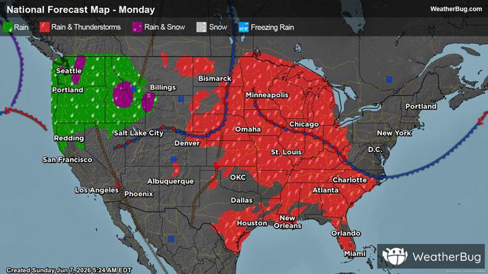
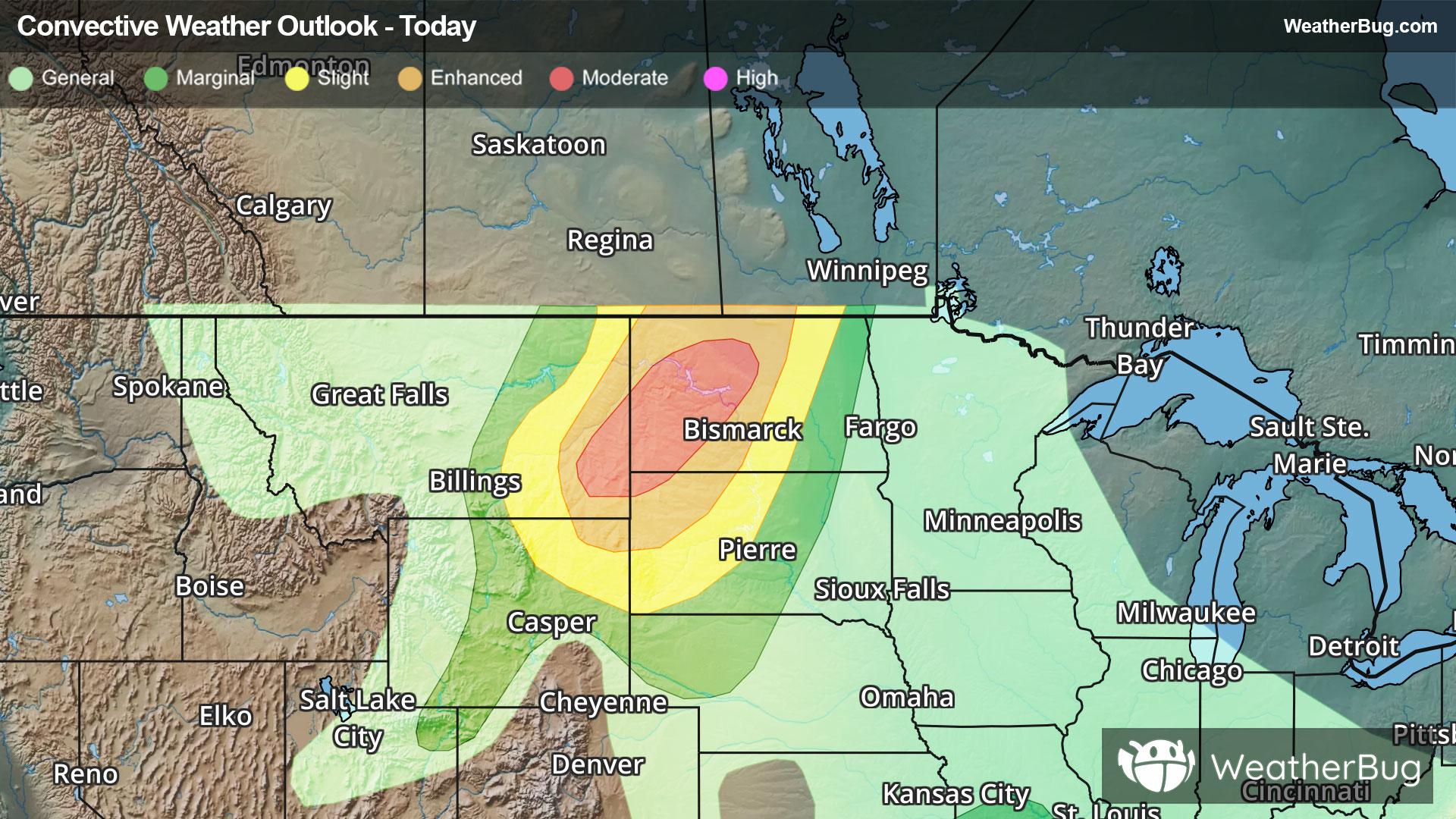
Sheboygan Falls, WI Weather

As of

Weather Station:County Arpt Sheboygan Falls

Open weather station selector modal

56degrees Fahrenheit

Feels like:56°F

Hi: 71Lo: 56

Partly Cloudy

Live Weather Radar

Sheboygan Falls, WI weather radar map

Current Weather Details

Windchill
56°
Daily Rain
0"
Dew point
50°
Monthly Rain
6.87"
Humidity
81%
Avg. Wind
S 7 mph
Pressure
29.69" →
Wind Gust
7 mph
Sunrise
5:55 AM
Moon
First Quarter
Sunset
7:44 PM
UV Index
6 (High)

Weather Forecast

  • Tonight

    Lo

    Partly cloudy in the evening then becoming mostly cloudy. Scattered light rain showers through around midnight. Chance of thunderstorms through the night. Numerous rain showers after midnight. Lows around 50 near the lake and in the upper 50s inland. South winds 5 to 15 mph. Chance of precipitation 70 percent.

  • Tomorrow

    Hi

    Mostly cloudy until late afternoon then clearing. Light rain showers likely and slight chance of thunderstorms through the day. Highs in the mid 60s. West winds 5 to 15 mph. Chance of precipitation 70 percent.

Sheboygan Falls, WI 10-day weather forecast

AIR QUALITY

32 | Fair

Top Triggers:pm25
Air quality data provided by Ambee
View Today's Air Quality details for Sheboygan Falls, WI

POLLEN COUNT & ALLERGY FORECAST

10.2 High

Predominant Pollen:Maple, Cedar/Juniper and Alder.
View the Pollen forecast details

LIGHTNING MAP

Closest strike in the last 30 minutes:79.0 miles

No Lightning Nearby

Real-time lightning alerts & live Map