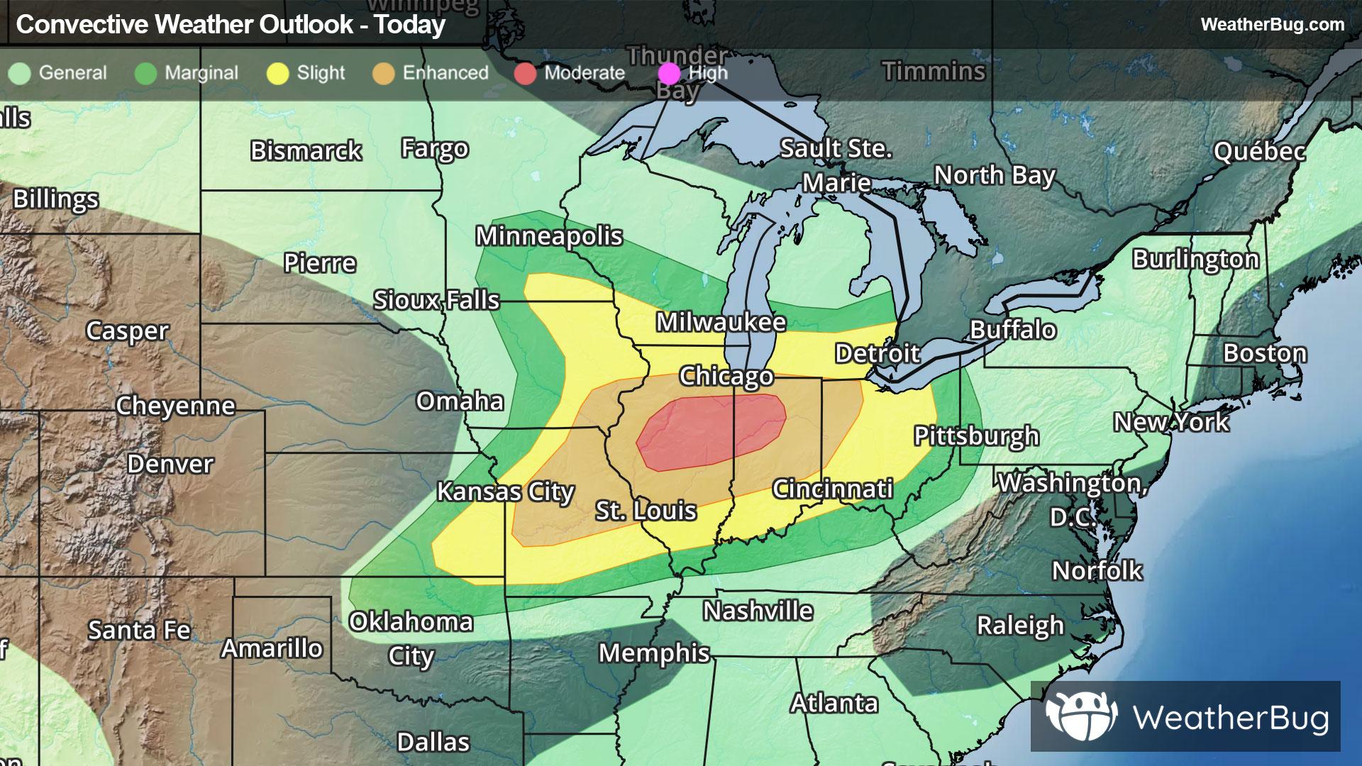
Severe Weather Outbreak Targets the Midwest
An outbreak of severe weather is expected across the Midwest today, including the risk for intense tornadoes.
Read More

70% Chance Rain Showers
Lo

Windy cooler. Mostly cloudy early in the evening then becoming partly cloudy. Rain showers likely and chance of thunderstorms early in the evening then slight chance of rain showers after midnight. Lows in the upper 40s. Northwest winds 15 to 30 mph decreasing to 10 to 15 mph after midnight. Gusts up to 45 mph. Chance of precipitation 70 percent.
Hi

Breezy cooler. Mostly sunny. A 20 percent chance of thunderstorms in the afternoon. Highs 63 to 69. Northwest winds 15 to 25 mph with gusts to around 40 mph.


Closest strike in the last 30 minutes:25.5 miles
Monitor Storms
An outbreak of severe weather is expected across the Midwest today, including the risk for intense tornadoes.