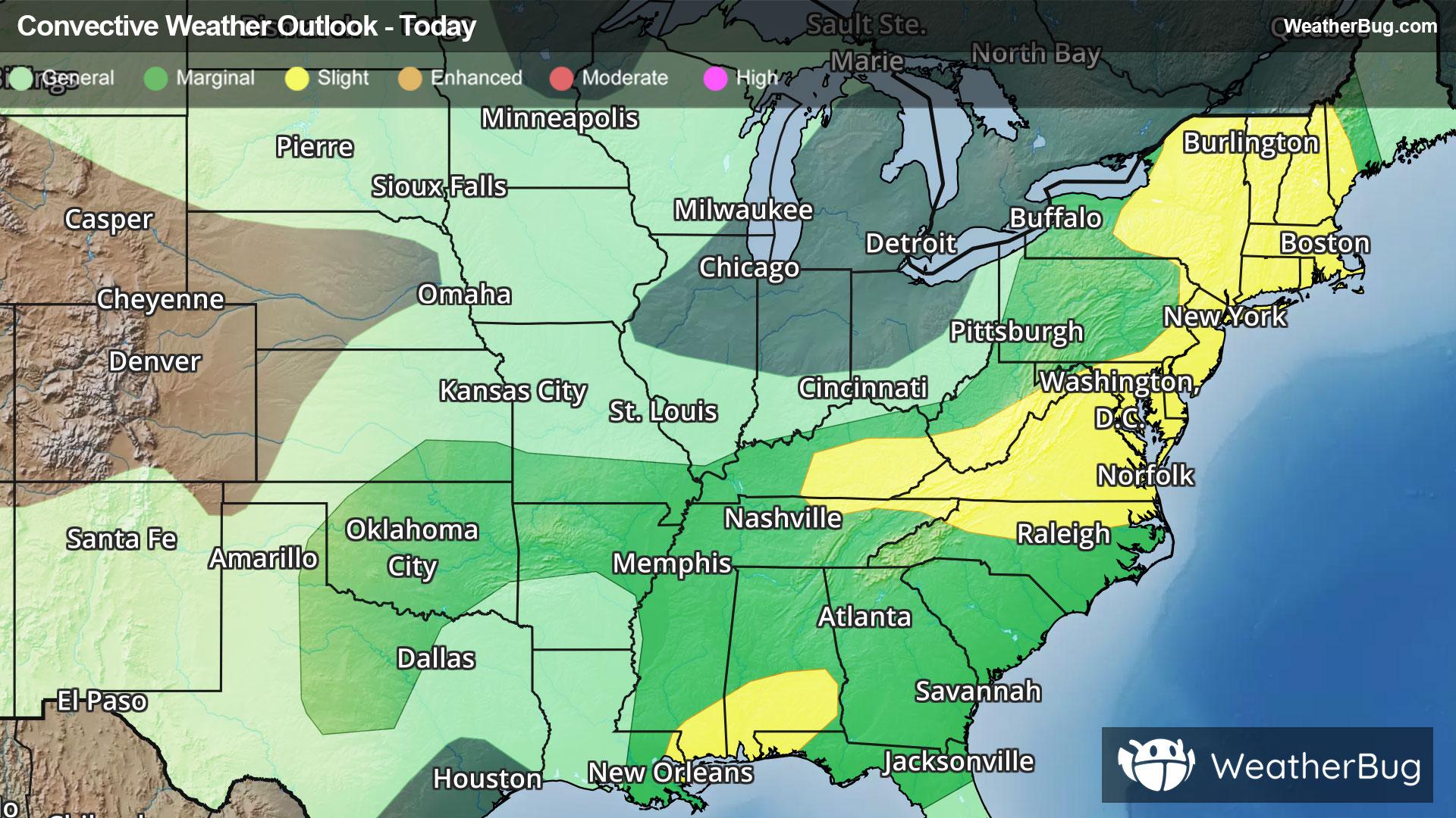
Severe Storms And Flooding Concerns Across The Eastern U.S.
Gusty winds and tornadoes will be the main severe threats, with storms also posing a risk for flooding.
Read More
73degrees Fahrenheit

Feels like:73°
Hi:73°Lo:64°
Partly Cloudy
Hi

Mostly sunny. Isolated showers in the morning then scattered showers in the afternoon. Highs 82 to 89 near the shore to 69 to 77 near 4000 feet. East winds up to 10 mph increasing to 10 to 15 mph in the afternoon. Chance of rain 40 percent.
Lo

Mostly clear. Isolated showers in the evening then scattered showers after midnight. Lows 69 to 75 near the shore to 51 to 57 near 4000 feet. Northeast winds up to 15 mph. Chance of rain 40 percent.


Closest strike in the last 30 minutes:2833.3 miles
No Lightning Nearby


