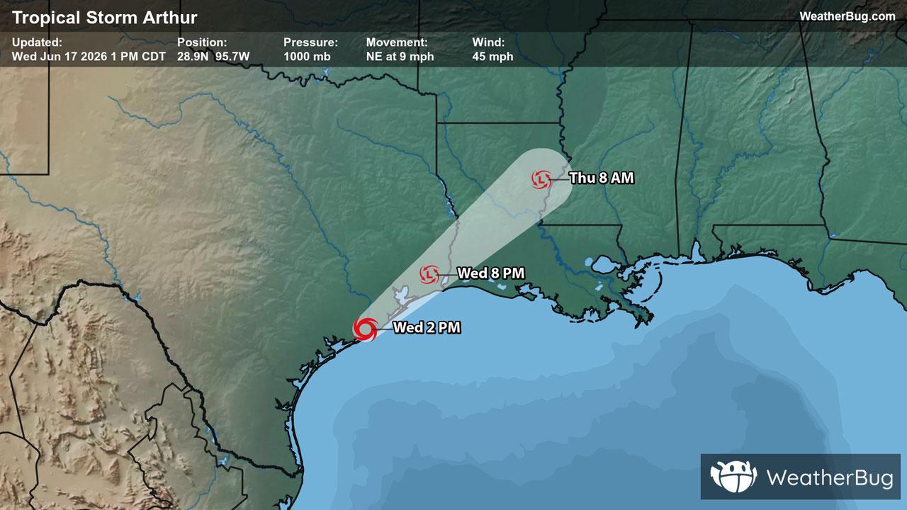
Severe Weather Outbreak Targets the Midwest
An outbreak of severe weather is expected across the Midwest today, including the risk for intense tornadoes.
Read More
57degrees Fahrenheit

Feels like:57°
Hi:60°Lo:54°
80% Chance of Light Rain
Hi

Showers and a slight chance of thunderstorms. Nearly steady temperature in the upper 50s. Southeast wind 10 to 15 mph. Chance of rain 90 percent.
Lo

Cloudy. Showers and a slight chance of thunderstorms in the evening then a chance of showers after midnight. Lows in the lower 50s. East wind 5 to 10 mph shifting to the northwest after midnight. Chance of rain 80 percent.

Closest strike in the last 30 minutes:171.5 miles
No Lightning Nearby
An outbreak of severe weather is expected across the Midwest today, including the risk for intense tornadoes.