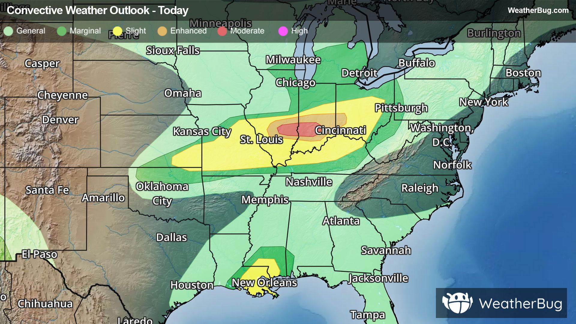
Severe Weather Outbreak Targets the Midwest
The Mississippi Valley remains abloom with severe thunderstorms this evening, with the threat stretching from Minnesota to Missouri and even along the Gulf Coast.
Read More
55degrees Fahrenheit

Feels like:55°
Hi:58°Lo:55°
70% Chance of Light Rain
Lo

Mostly cloudy with likely rain. Chance of precipitation 100%. Low temperature around 56F. Dew point will be around 57F with an average humidity of 97%. Winds will be 6 mph from the NW.
Hi

Partly cloudy with a slight chance of rain. Chance of precipitation 30%. High temperature around 67F. Dew point will be around 55F with an average humidity of 74%. Winds will be 10 mph from the NW.


Closest strike in the last 30 minutes:283.3 miles
No Lightning Nearby


