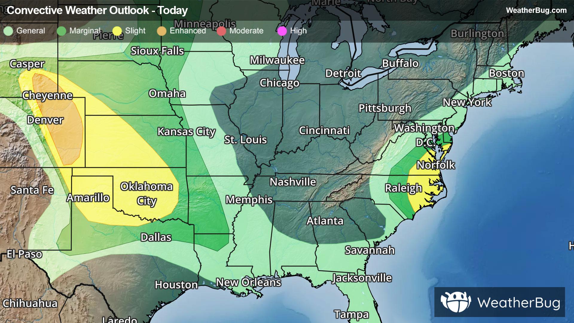
Thunderstorms to Rumble Across the Plains, Atlantic Coast
There are a pair of areas to watch in terms of severe thunderstorms today
Read More
61degrees Fahrenheit

Feels like:61°
Hi:68°Lo:54°
70% Chance Rain Showers
Hi

Showers and a slight chance of thunderstorms in the morning then a chance of showers and thunderstorms in the afternoon. Highs in the lower 70s. Southwest winds 10 to 15 mph. Chance of precipitation near 100 percent.
Lo

Partly cloudy with a slight chance of showers and thunderstorms in the evening then mostly clear after midnight. Lows in the lower 50s. Light and variable winds. Chance of precipitation 20 percent.


Closest strike in the last 30 minutes:149.1 miles
No Lightning Nearby


