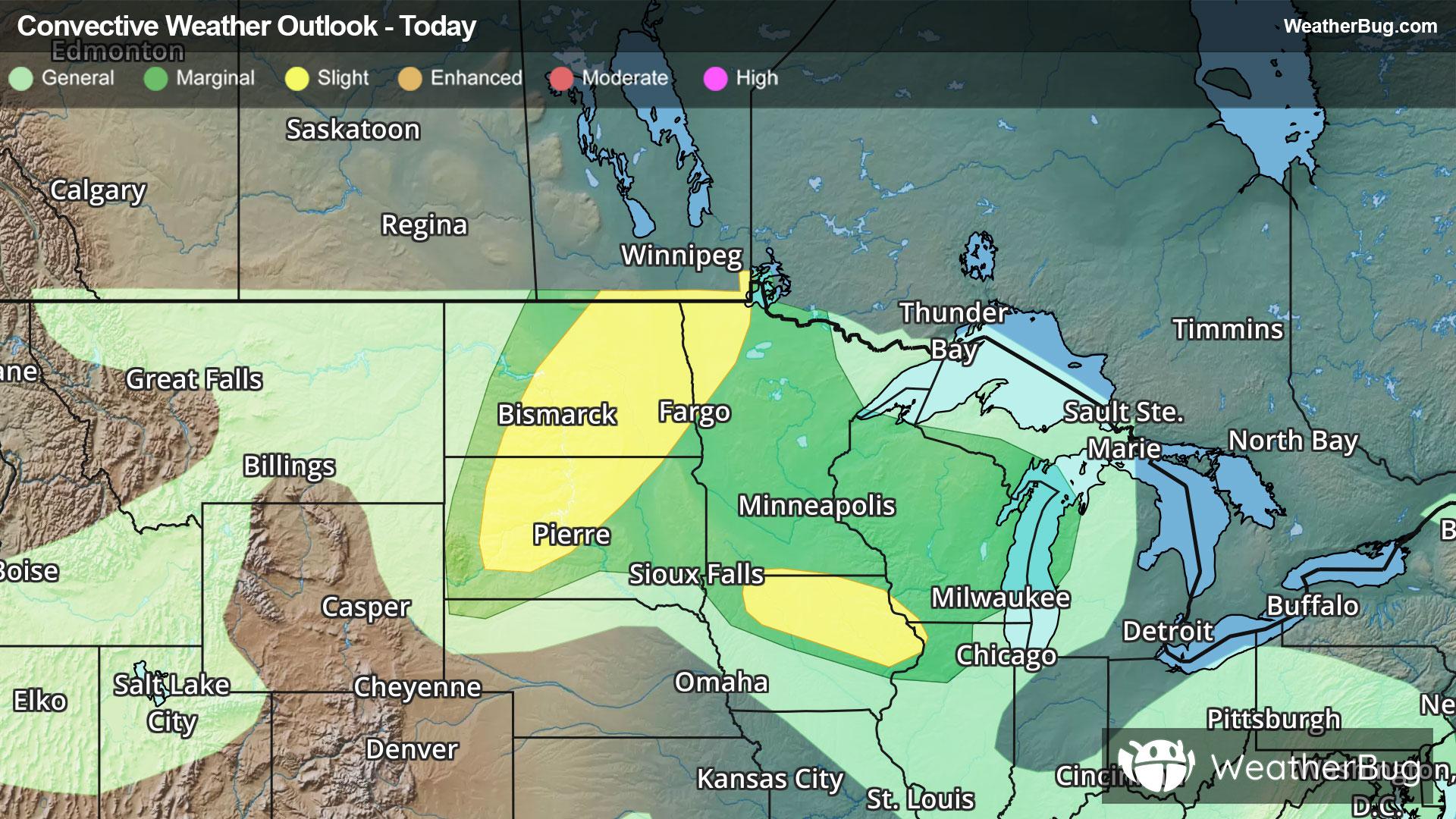
Storms And Flooding Impact The Northern Plains To Tennessee
Strong to severe thunderstorms will occur across the northern Plains today bringing risks that will impact travel.
Read More
68degrees Fahrenheit

Feels like:68°
Hi:70°Lo:68°
70% Chance of Light Rain
Lo

Mostly cloudy with a 30 percent chance of showers. Patchy fog. Lows in the mid 60s. Light and variable winds.
Hi

Mostly cloudy. Patchy fog in the morning. A chance of showers in the morning then showers likely with a chance of thunderstorms in the afternoon. Highs in the lower 80s. Northeast winds around 5 mph. Chance of rain 60 percent.


Closest strike in the last 30 minutes:267.5 miles
No Lightning Nearby
Strong to severe thunderstorms will occur across the northern Plains today bringing risks that will impact travel.


