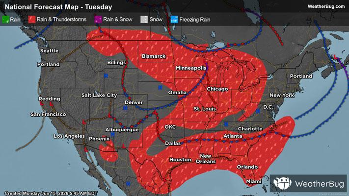
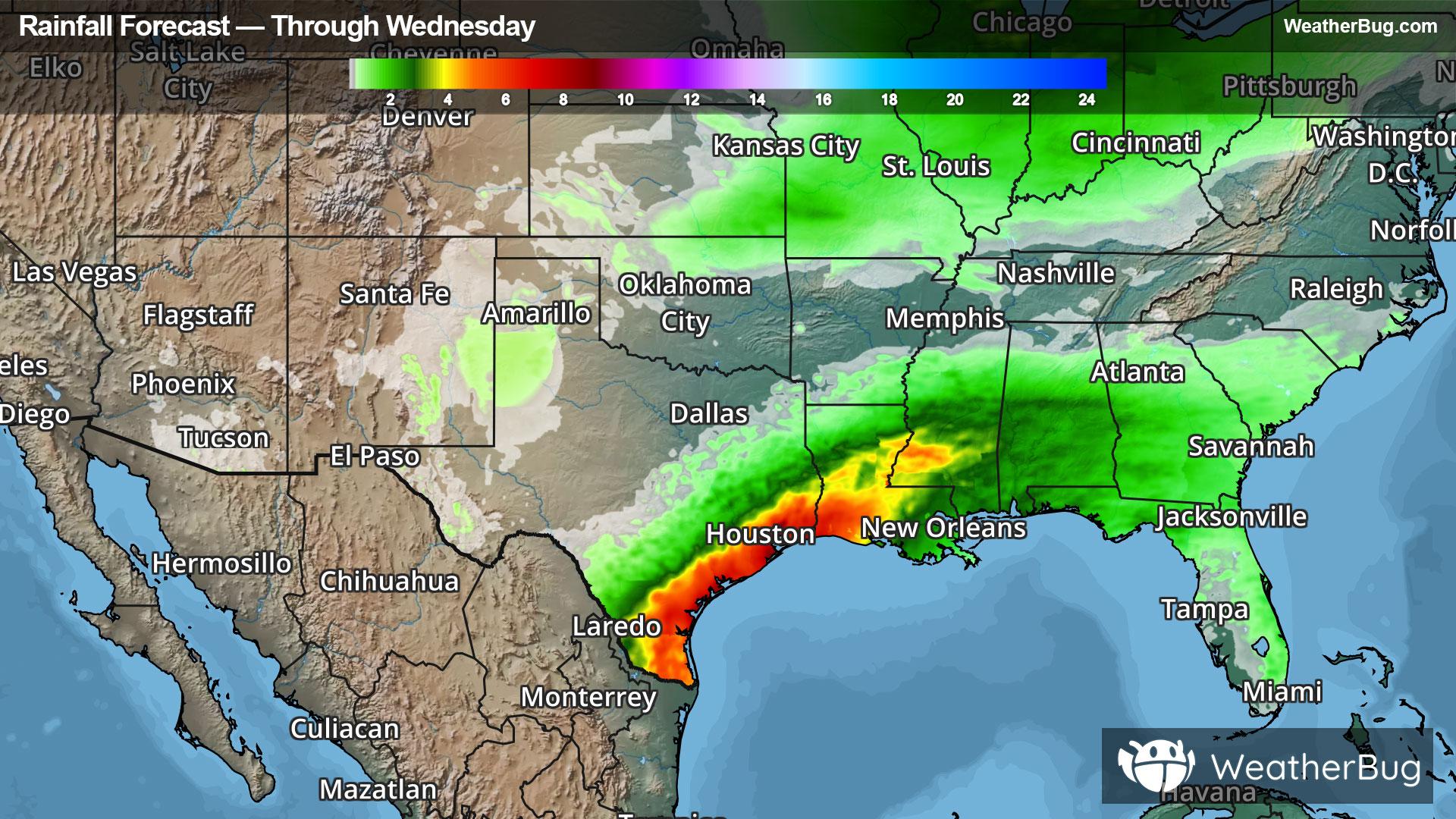
Superior, WI Weather

As of

Weather Station:Richard Bong Arpt Superior

Open weather station selector modal

36degrees Fahrenheit

Feels like:31°F

Hi: 36Lo: 36

Partly Cloudy

Live Weather Radar

Superior, WI weather radar map

Current Weather Details

Windchill
31°
Daily Rain
0"
Dew point
34°
Monthly Rain
1.55"
Humidity
93%
Avg. Wind
N 6 mph
Pressure
29.68" →
Wind Gust
6 mph
Sunrise
6:17 AM
Moon
Sunset
7:58 PM
UV Index
3 (Moderate)

Weather Forecast

  • Tonight

    Lo

    Partly cloudy. Low temperature around 36F. Dew point will be around 36F with an average humidity of 81%. Winds will be 6 mph from the NE.

  • Tomorrow

    Hi

    Partly sunny with a slight chance of rain and thunderstorms this morning then rain with a chance of thunderstorms this afternoon. Highs in the upper 60s. Temperature falling into the upper 40s this afternoon. South winds 10 to 15 mph becoming west this afternoon. Gusts up to 30 mph. Chance of rain near 100 percent.

Superior, WI 10-day weather forecast

AIR QUALITY

23 | Fair

Top Triggers:pm25
Air quality data provided by Ambee
View Today's Air Quality details for Superior, WI

POLLEN COUNT & ALLERGY FORECAST

9 Medium-High

Predominant Pollen:Cedar/Juniper, Alder and Elm.
View the Pollen forecast details

LIGHTNING MAP

Closest strike in the last 30 minutes:2654.7 miles

No Lightning Nearby

Real-time lightning alerts & live Map