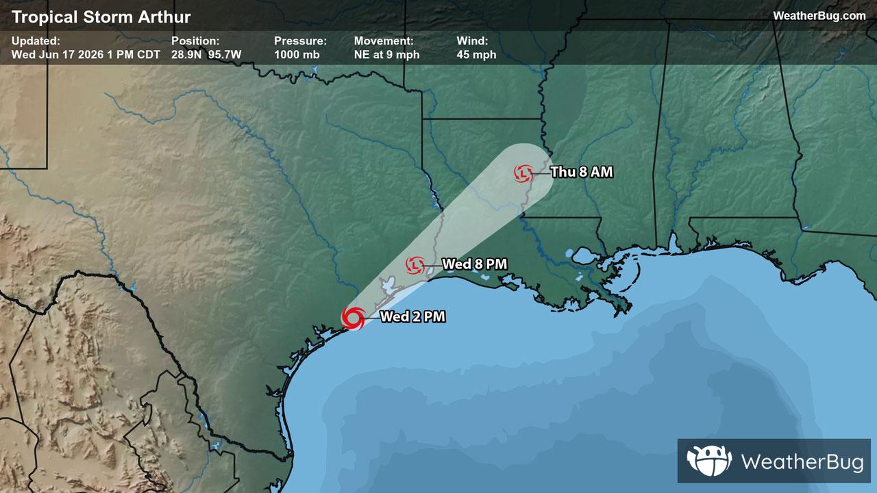
Severe Weather Outbreak Targets the Midwest
An outbreak of severe weather is expected across the Midwest today, including the risk for intense tornadoes.
Read More

30% Chance Rain Showers
Hi

Showers likely with a chance of thunderstorms. Highs in the mid 70s. Southwest winds 5 to 10 mph. Chance of rain 70 percent.
Lo

Partly cloudy with a chance of showers with a slight chance of thunderstorms in the evening then mostly cloudy with showers likely after midnight. Lows in the upper 50s. South winds 5 to 10 mph. Gusts up to 25 mph after midnight. Chance of rain 70 percent.

Closest strike in the last 30 minutes:267.1 miles
No Lightning Nearby
An outbreak of severe weather is expected across the Midwest today, including the risk for intense tornadoes.