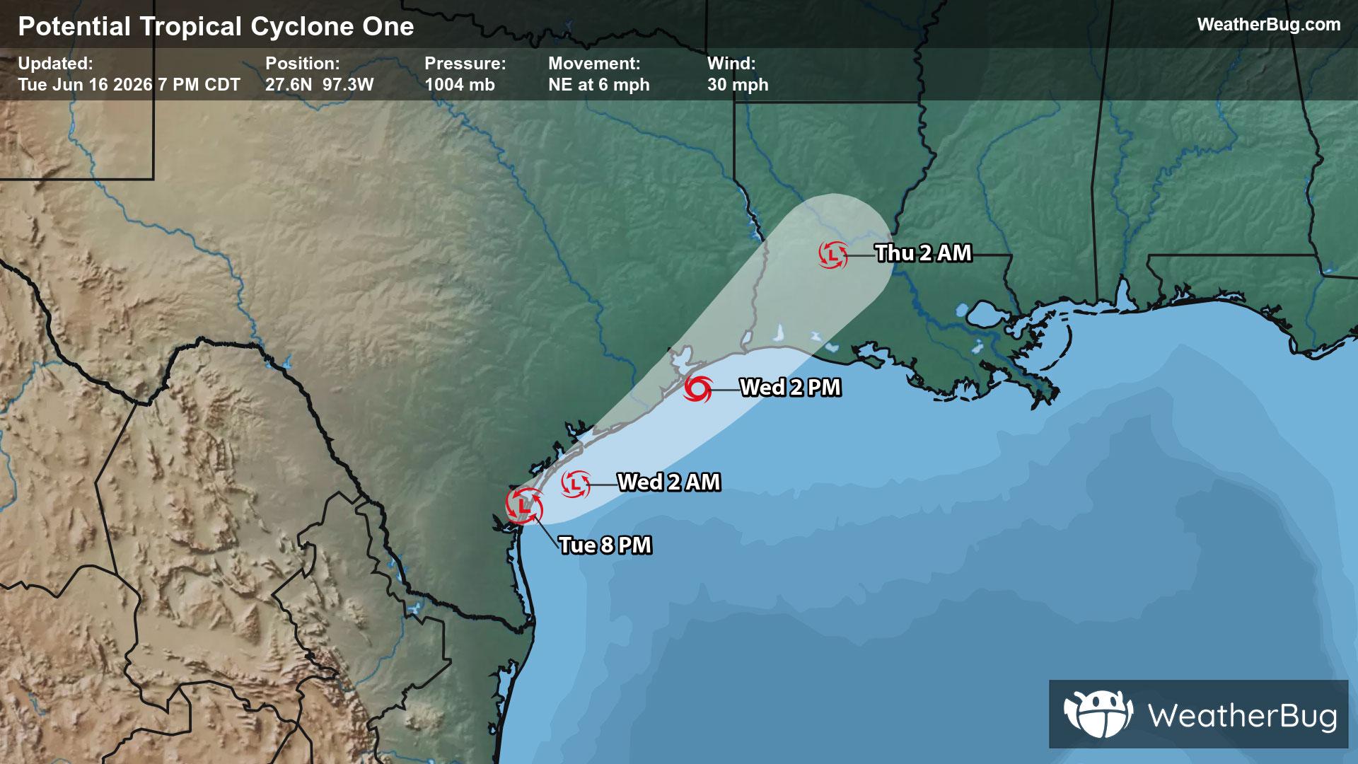
Potential Tropical Cyclone One May Become Atlantic's First Named Storm
A disorganized Potential Tropical Cyclone One may become the Atlantic season's first named storm on Wednesday.
Read More

Sunny
Hi

Mostly sunny. High temperature around 89F. Dew point will be around 36F with an average humidity of 23%. Winds will be 10 mph from the W.
Lo

Mostly clear. Lows 59 to 64. Windy. West winds 15 to 25 mph with gusts to 35 mph.


Closest strike in the last 30 minutes:493.0 miles
No Lightning Nearby
A disorganized Potential Tropical Cyclone One may become the Atlantic season's first named storm on Wednesday.


