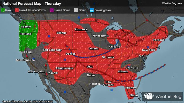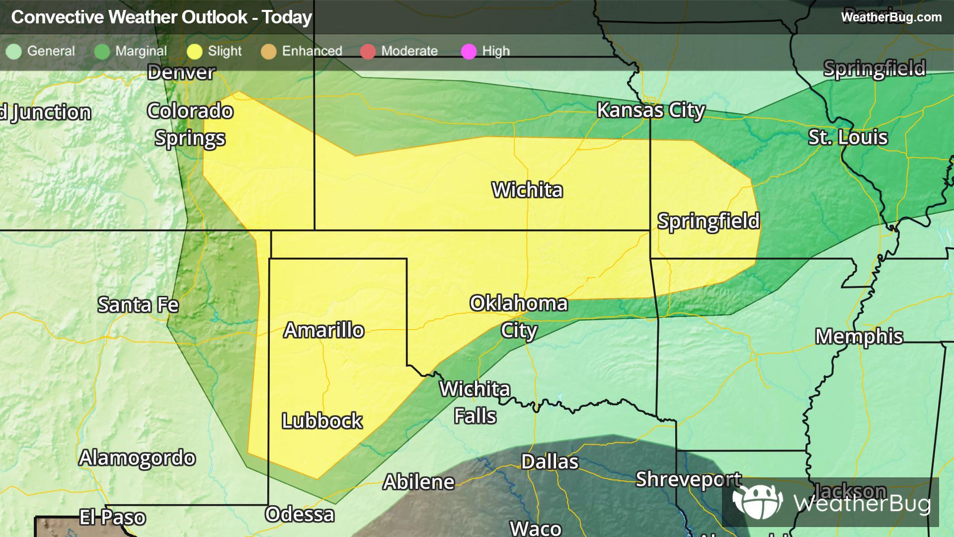
Central & Southern Plains Under Severe Threat
A low pressure system tracking across the central U.S. will produce severe thunderstorms over the southern Plains today.
Read More
68degrees Fahrenheit

Feels like:68°
Hi:87°Lo:67°
Partly Cloudy
Hi

Partly cloudy. A slight chance of showers this morning. Chance of rain 20 percent. Highs 87 to 92. West winds 10 to 15 mph with gusts to 25 mph.
Lo

Increasing clouds. Lows 58 to 63. Northwest winds 10 to 15 mph in the evening shifting to southwest after midnight. Gusts to 30 mph.


Closest strike in the last 30 minutes:186.9 miles
No Lightning Nearby