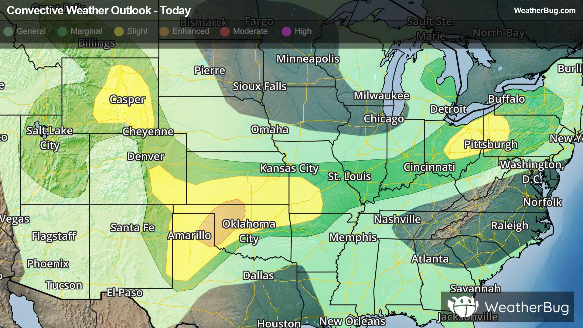
Central & Southern Plains Under Severe Threat
A low pressure system tracking across the central U.S. will produce severe thunderstorms over the southern Plains today.
Read More
68degrees Fahrenheit

Feels like:68°
Hi:83°Lo:54°
Cloudy
Lo

Cloudy. A chance of rain showers overnight. Lows in the lower to mid 50s. West wind 5 to 15 mph in the evening becoming light and variable. Gusts up to 25 mph. Chance of precipitation 50 percent.
Hi

Mostly cloudy. A chance of rain showers in the morning then a chance of showers and thunderstorms in the afternoon. Highs in the upper 60s to mid 70s. Gusts up to 20 mph. Chance of precipitation 50 percent. Rainfall amounts less than a tenth of an inch except higher amounts possible in thunderstorms.


Closest strike in the last 30 minutes:339.6 miles
No Lightning Nearby


