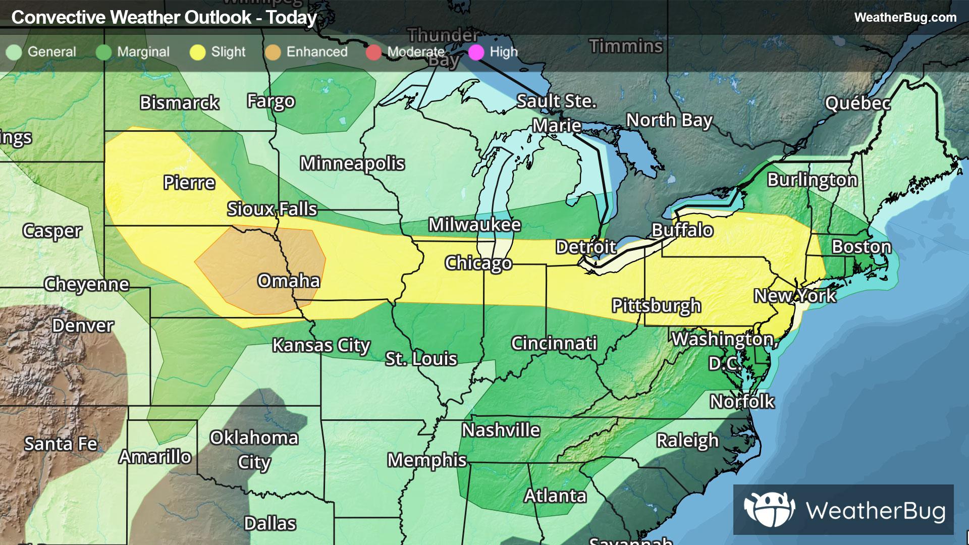
Vermont, WI Weather

As of

Weather Station:Middleton Arpt Morey Field

Open weather station selector modal

53degrees Fahrenheit

Feels like:53°F

Hi: 53Lo: 33

Mostly Sunny

Live Weather Radar

Vermont, WI weather radar map

Current Weather Details

Windchill
53°
Daily Rain
0"
Dew point
32°
Monthly Rain
1.43"
Humidity
46%
Avg. Wind
E 15 mph
Pressure
29.85" ↘
Wind Gust
22 mph
Sunrise
7:20 AM
Moon
Third Quarter
Sunset
6:59 PM
UV Index
4 (Moderate)

Weather Forecast

  • Today

    Hi

    Cooler. Mostly sunny early in the afternoon then cloudy with light rain likely and slight chance of thunderstorms late in the afternoon. Highs around 50. East winds around 15 mph. Chance of precipitation 60 percent.

  • Tonight

    Lo

    Cloudy. Patchy fog through the night. Light rain and chance of thunderstorms through around midnight. Chance of light rain after midnight. Chance of light freezing rain early in the morning. Lows in the lower 30s. Northeast winds 10 to 15 mph. Chance of precipitation 90 percent.

Vermont, WI 10-day weather forecast

AIR QUALITY

15 | Excellent

Top Triggers:pm25
Air quality data provided by Ambee
View Today's Air Quality details for Vermont, WI

POLLEN COUNT & ALLERGY FORECAST

6.1 Medium

Predominant Pollen:Cedar/Juniper
View the Pollen forecast details

LIGHTNING MAP

Closest strike in the last 30 minutes:530.1 miles

No Lightning Nearby

Real-time lightning alerts & live Map