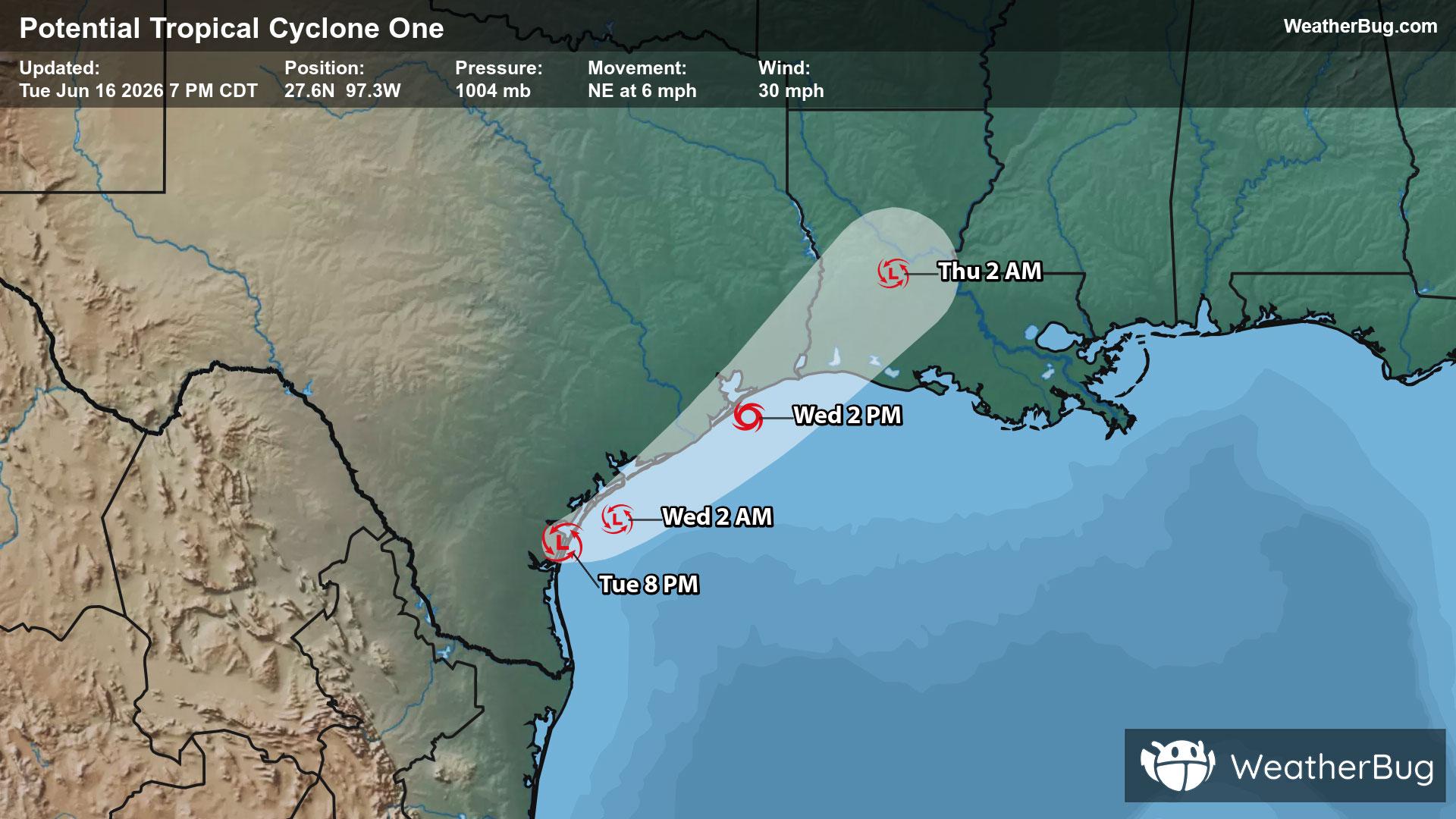
Vernonia, OR Weather

As of

Weather Station:City of Banks Public Library

Open weather station selector modal

44degrees Fahrenheit

Feels like:44°F

Hi: 44Lo: 31

70% Chance Rain Showers

Live Weather Radar

Vernonia, OR weather radar map

Current Weather Details

Windchill
44°
Daily Rain
0.03"
Dew point
38°
Monthly Rain
0.44"
Humidity
77%
Avg. Wind
S 2 mph
Pressure
30.16" ↓
Wind Gust
SSE 5 mph
Sunrise
7:37 AM
Moon
Waning Gibbous
Sunset
7:10 PM
UV Index
3 (Moderate)

Weather Forecast

  • Today

    Hi

    Partly sunny early then becoming mostly cloudy. A chance of rain early then rain likely a slight chance of thunderstorms and snow showers. Snow level 1500 feet. No snow accumulation. Highs in the mid 40s. West wind 5 to 10 mph. Chance of precipitation 70 percent. Rainfall amounts a tenth to a quarter of an inch.

  • Tonight

    Lo

    Rain likely a slight chance of thunderstorms and snow in the evening then a chance of rain and snow after midnight. Patchy fog after midnight. Snow level 1000 feet. Snow accumulation up to 1 inch. Lows in the lower 30s. Southwest wind 5 to 10 mph. Chance of precipitation 70 percent. Rainfall amounts a tenth to a quarter of an inch.

Vernonia, OR 10-day weather forecast

AIR QUALITY

19 | Excellent

Top Triggers:pm25
Air quality data provided by Ambee
View Today's Air Quality details for Vernonia, OR

POLLEN COUNT & ALLERGY FORECAST

2.8 Low-Medium

Predominant Pollen:Cedar/Juniper, Hazelnut and Elm
View the Pollen forecast details

LIGHTNING MAP

Closest strike in the last 30 minutes:1247.9 miles

No Lightning Nearby

Real-time lightning alerts & live Map