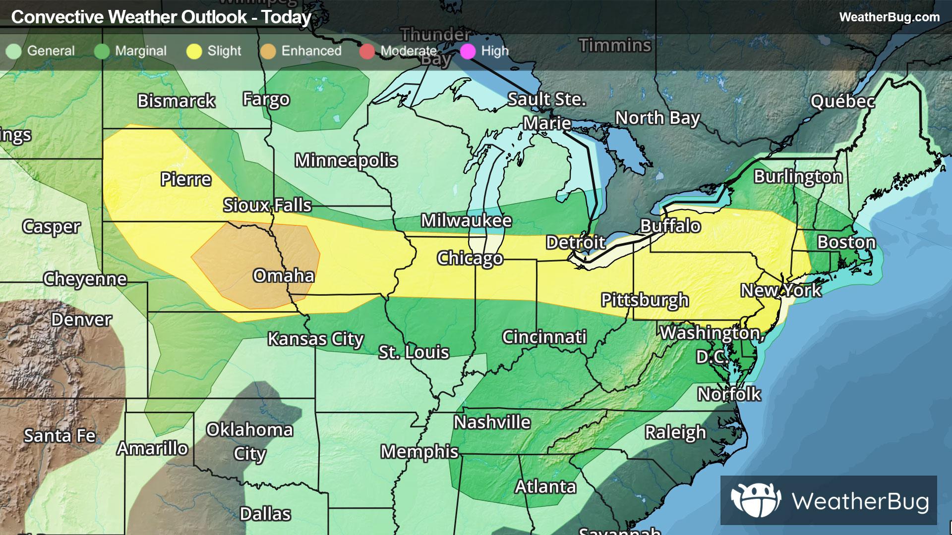
Severe Weather Stretches from High Plains to Northeast
Another round of severe weather will occur from the central and northern Plains through the Midwest and into Northeast today.
Read More
79degrees Fahrenheit

Feels like:79°
Hi:82°Lo:53°
Sunny
Hi

Sunny. Highs in the lower 80s. Northwest wind 5 to 10 mph.
Lo

Mostly clear. Lows in the lower 50s. Northwest wind 5 to 10 mph becoming light after midnight.


Closest strike in the last 30 minutes:465.0 miles
No Lightning Nearby
Another round of severe weather will occur from the central and northern Plains through the Midwest and into Northeast today.


