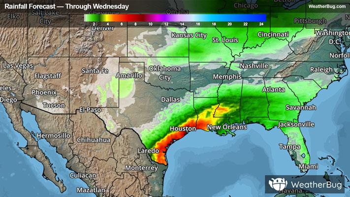
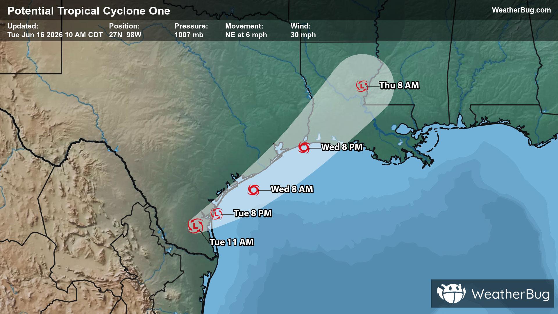
Wanaque, NJ

Weather

As of
Current Temperature
68
Feels like:68°
Today's high temperature
68°
Today's low temperature
68°

70% Chance of Light Rain

Live Weather Radar

Wanaque, NJ weather radar map

Current Weather Details

Windchill
68°
Daily Rain
0.16"
Dew point
68°
Monthly Rain
0.96"
Humidity
100%
Avg. Wind
S 2 mph
Pressure
29.63" →
Wind Gust
SSE 5 mph
Sunrise
5:24 AM
Moon
New
Sunset
8:31 PM
UV Index
9 (Very High)

Weather Forecast

  • Tonight

    Lo

    Showers with a chance of thunderstorms. Some thunderstorms may produce gusty winds this evening. Lows around 60. South winds 5 to 10 mph becoming west after midnight. Gusts up to 25 mph. Chance of rain 90 percent.

  • Tomorrow

    Hi

    Sunny cooler. Less humid with highs in the lower 70s. Northwest winds 5 to 10 mph with gusts up to 25 mph.

Wanaque, NJ 10-day weather forecast

AIR QUALITY

Air Quality Index
32|Fair
Top Triggers:
pm25
View Today's Air Quality details for Wanaque, NJ

POLLEN COUNT & ALLERGY FORECAST

Pollen Count
5.4|Medium
Predominant Pollen:
Grass
Wanaque, NJ Pollen forecast details

LIGHTNING MAP

Closest strike in the last 30 minutes:60.4 miles

No Lightning Nearby

Wanaque, NJ real-time lightning alerts & live Map