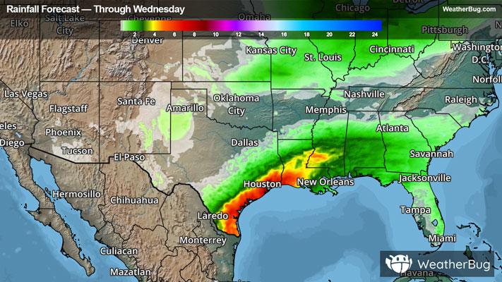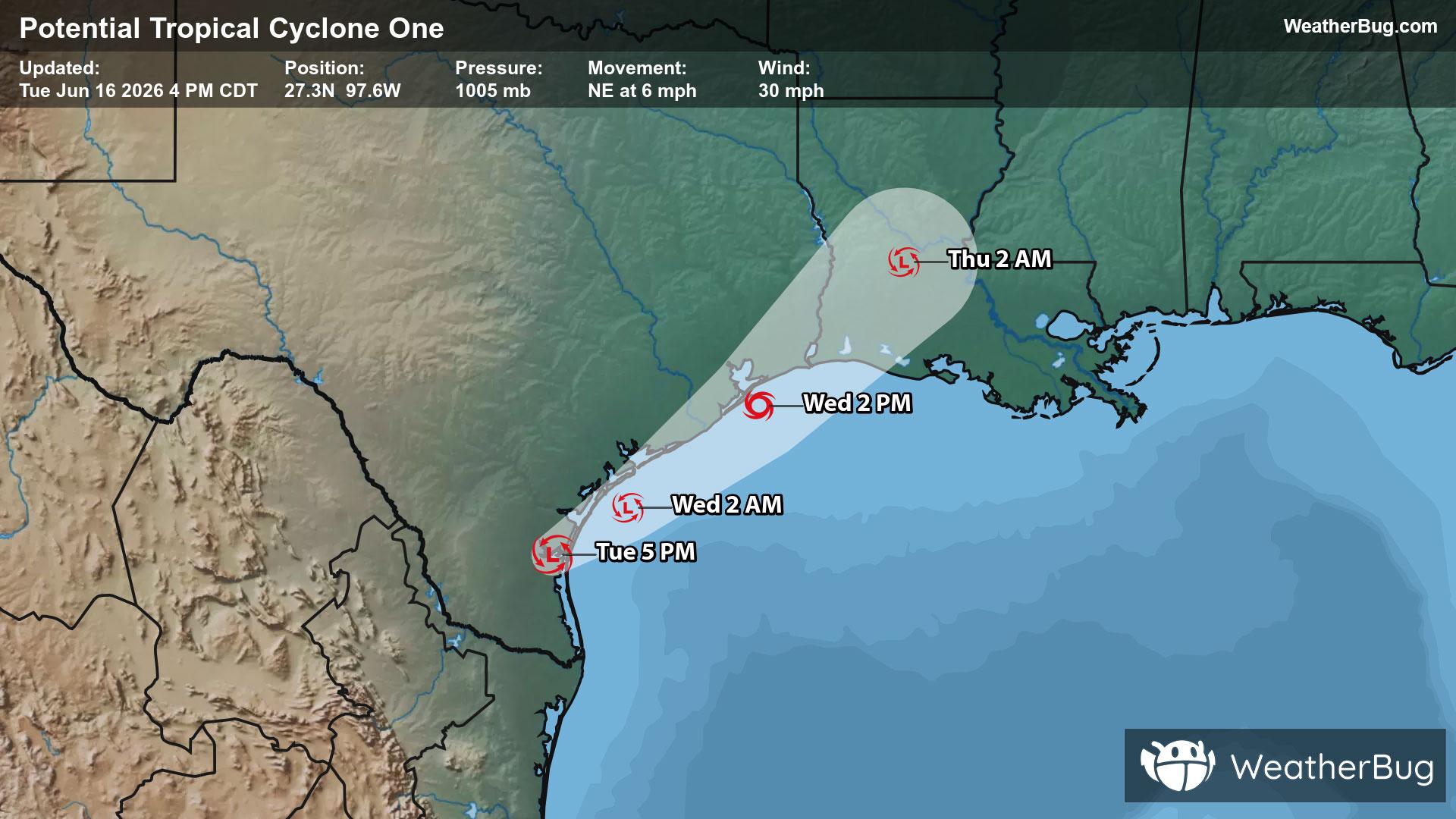
Potential Tropical Cyclone One May Become Atlantic's First Named Storm
A disorganized Potential Tropical Cyclone One may become the Atlantic season's first name storm on Wednesday.
Read More

Mostly Sunny
Hi

Sunny. High temperature around 76F. Dew point will be around 47F with an average humidity of 57%. Winds will be 6 mph from the NW.
Lo

Mostly clear. Patchy fog after midnight. Lows in the lower 50s. Light and variable winds.


Closest strike in the last 30 minutes:273.9 miles
No Lightning Nearby
A disorganized Potential Tropical Cyclone One may become the Atlantic season's first name storm on Wednesday.