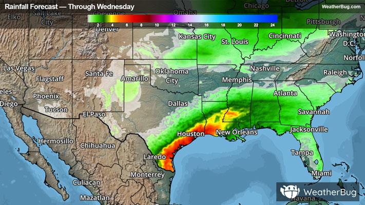
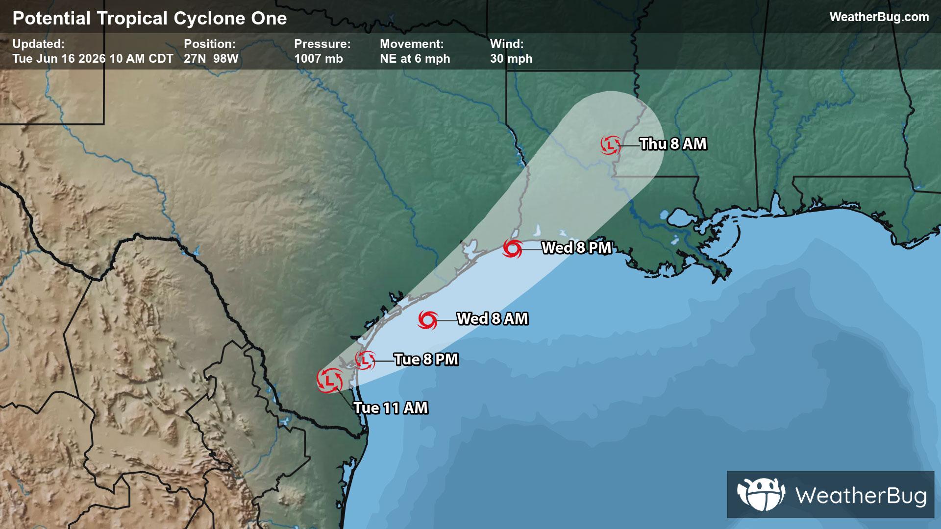
Washington, CT

Weather

As of
Current Temperature
65
Feels like:65°
Today's high temperature
65°
Today's low temperature
64°

80% Chance of Light Rain

Live Weather Radar

Washington, CT weather radar map

Current Weather Details

Windchill
65°
Daily Rain
0"
Dew point
65°
Monthly Rain
1.48"
Humidity
100%
Avg. Wind
SSE 4 mph
Pressure
29.67" →
Wind Gust
SSW 10 mph
Sunrise
5:18 AM
Moon
New
Sunset
8:29 PM
UV Index
9 (Very High)

Weather Forecast

  • Tonight

    Lo

    Mostly cloudy with a chance of thunderstorms. A chance of showers this evening then showers after midnight. Some thunderstorms may produce gusty winds and heavy rainfall. Lows in the upper 50s. South winds 10 to 15 mph. Chance of rain 90 percent.

  • Tomorrow

    Hi

    Sunny. A chance of showers in the morning. Not as warm with highs in the upper 70s. Northwest winds 5 to 10 mph. Chance of rain 30 percent.

Washington, CT 10-day weather forecast

AIR QUALITY

Air Quality Index
34|Fair
Top Triggers:
o3
View Today's Air Quality details for Washington, CT

POLLEN COUNT & ALLERGY FORECAST

Pollen Count
7.6|Medium-High
Predominant Pollen:
Oak, Grass
Washington, CT Pollen forecast details

LIGHTNING MAP

Closest strike in the last 30 minutes:83.0 miles

No Lightning Nearby

Washington, CT real-time lightning alerts & live Map