Northern Lights This Weekend: Will Clouds Block the View?
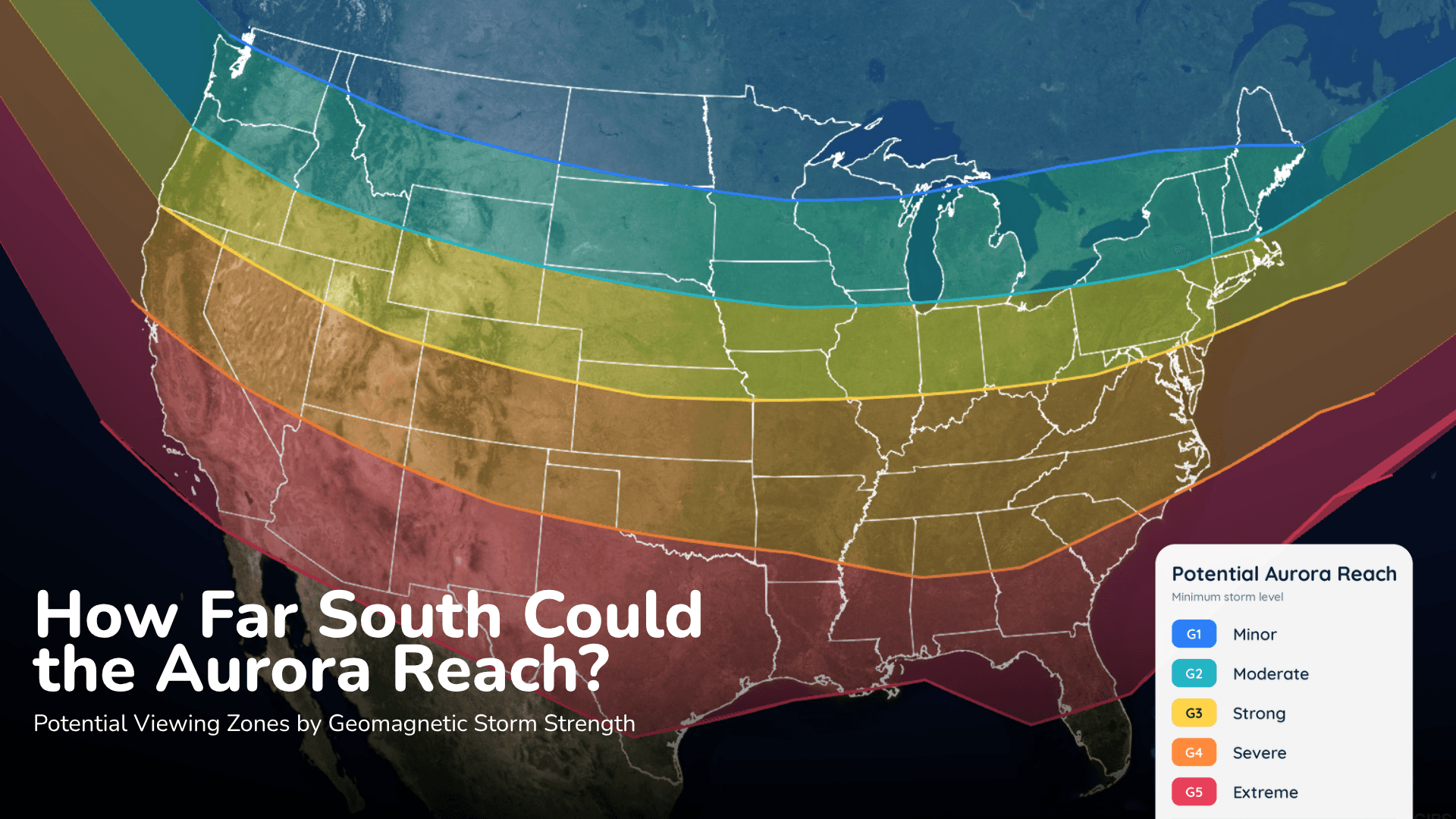
Aurora could reach parts of the northern United States Saturday night, but the cloud forecast may decide who actually sees it.
Read More
63degrees Fahrenheit

Feels like:63°
Hi:73°Lo:59°
Rain
Hi

Breezy. Rain showers and isolated thunderstorms in the morning, then rain showers and scattered thunderstorms in the afternoon. Patchy blowing dust in the afternoon. Some thunderstorms may produce heavy rainfall in the morning. Some thunderstorms may produce heavy rainfall in the afternoon. Highs in the upper 70s. East winds 10 to 20 mph shifting to the south 15 to 25 mph in the afternoon. Chance of precipitation near 100 percent.
Lo

Rain showers and isolated thunderstorms in the evening, then numerous rain showers and isolated thunderstorms after midnight. Areas of blowing dust through the night. Some thunderstorms may produce heavy rainfall. Lows in the upper 50s. South winds 10 to 20 mph shifting to the southeast after midnight. Chance of precipitation 90 percent.


Rain ending in 21 minutes, starting again in 33 minutes.
Closest strike in the last 30 minutes:1411.6 miles
No Lightning Nearby


Aurora could reach parts of the northern United States Saturday night, but the cloud forecast may decide who actually sees it.