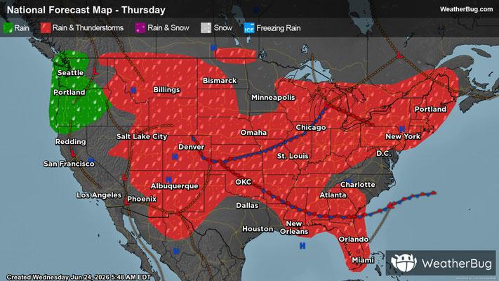
Intermountain West, High Plains Targeted by Severe Thunderstorms
The High Plains and a portion of the Intermountain West are locations to watch for severe thunderstorms today
Read More
60degrees Fahrenheit

Feels like:60°
Hi:74°Lo:50°
70% Chance Rain Showers
Hi

Showers and thunderstorms likely. Some thunderstorms may produce small hail. Near steady temperature around 70. Temperature falling into the upper 60s late. Northwest winds 5 to 10 mph. Chance of rain 70 percent.
Lo

Mostly cloudy. A chance of showers and thunderstorms in the evening. Some thunderstorms may produce small hail in the evening. Lows in the upper 40s. North winds around 5 mph. Chance of rain 50 percent.


Closest strike in the last 30 minutes:60.8 miles
No Lightning Nearby